Down at the Lah De Dah
In which we learn something new and raise a glass.
Just a few things to mention before we jump in:
- Welcome to the new subscribers! I hope you enjoy your stay in this small corner of the internet.
- I’m taking a short birthday break, so the next post will be delayed a bit.
2.2 inches doesn’t seem like much
But that’s what Hilary dropped on Death Valley in a day. It set a record, one that was pretty short-lived since the last one was set in 2022 (at 1.7 inches). They’re still assessing the damages, but it’s clear there have been major impacts.
"Two inches of rain does not sound like a lot, but here, it really does stay on the surface," said Matthew Lamar, a park ranger. "We have these hard, rocky areas — there's nothing to absorb that water, and so it comes off the mountains, into the canyons and through the washes and drainages and up into the infrastructure. Two inches of rain here can have a dramatic impact."
Source
And because there’s nothing to soak that rain up…
"It certainly reshaped the landscape," he said. "Alluvial fans were reshaped, canyons were reshaped. Things that were there before will no longer be there."
Source
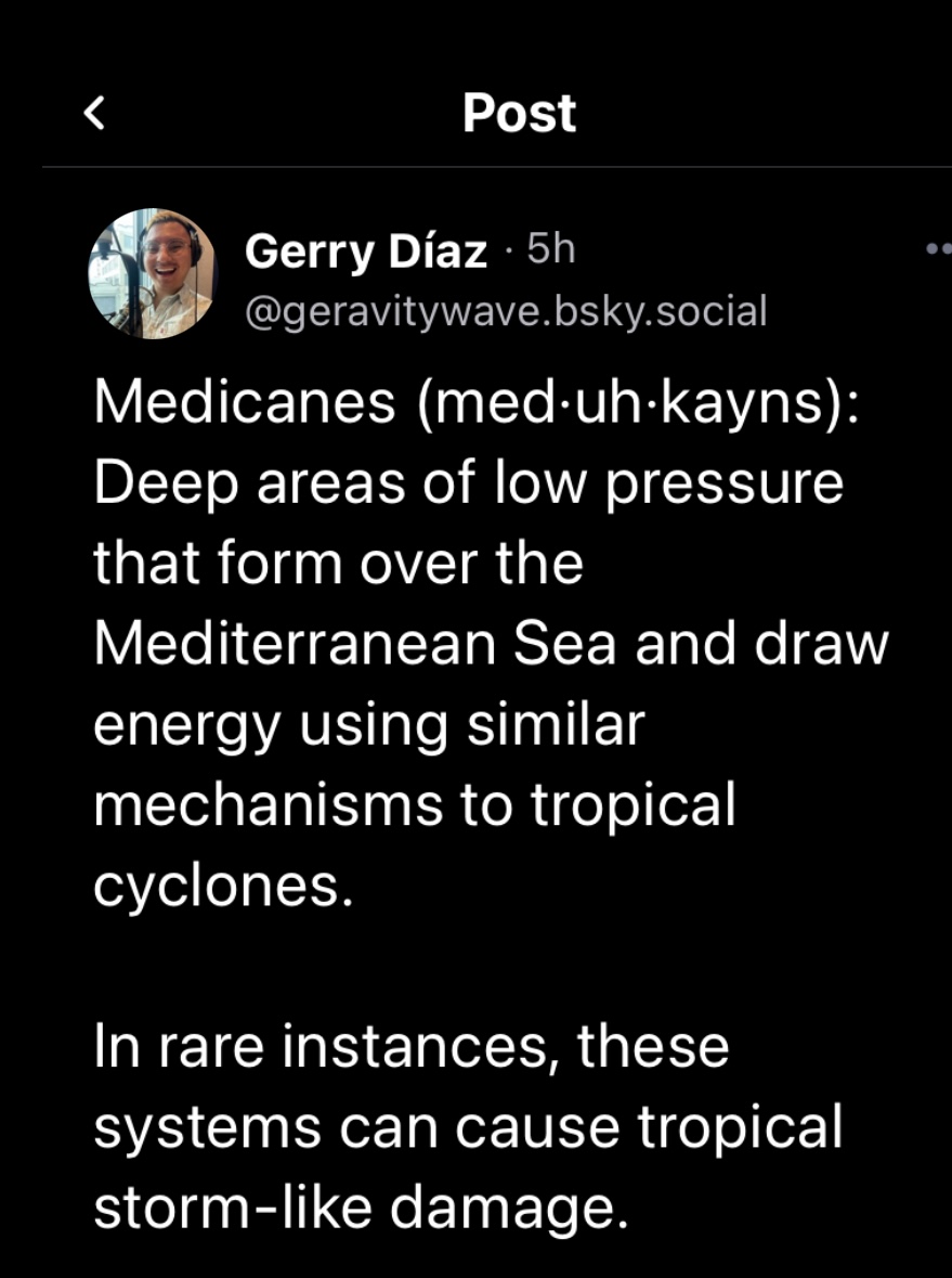
Say what?
Today’s word is “medicanes”. Be warned, if you try to use it in a sentence, autocorrect will jump in.
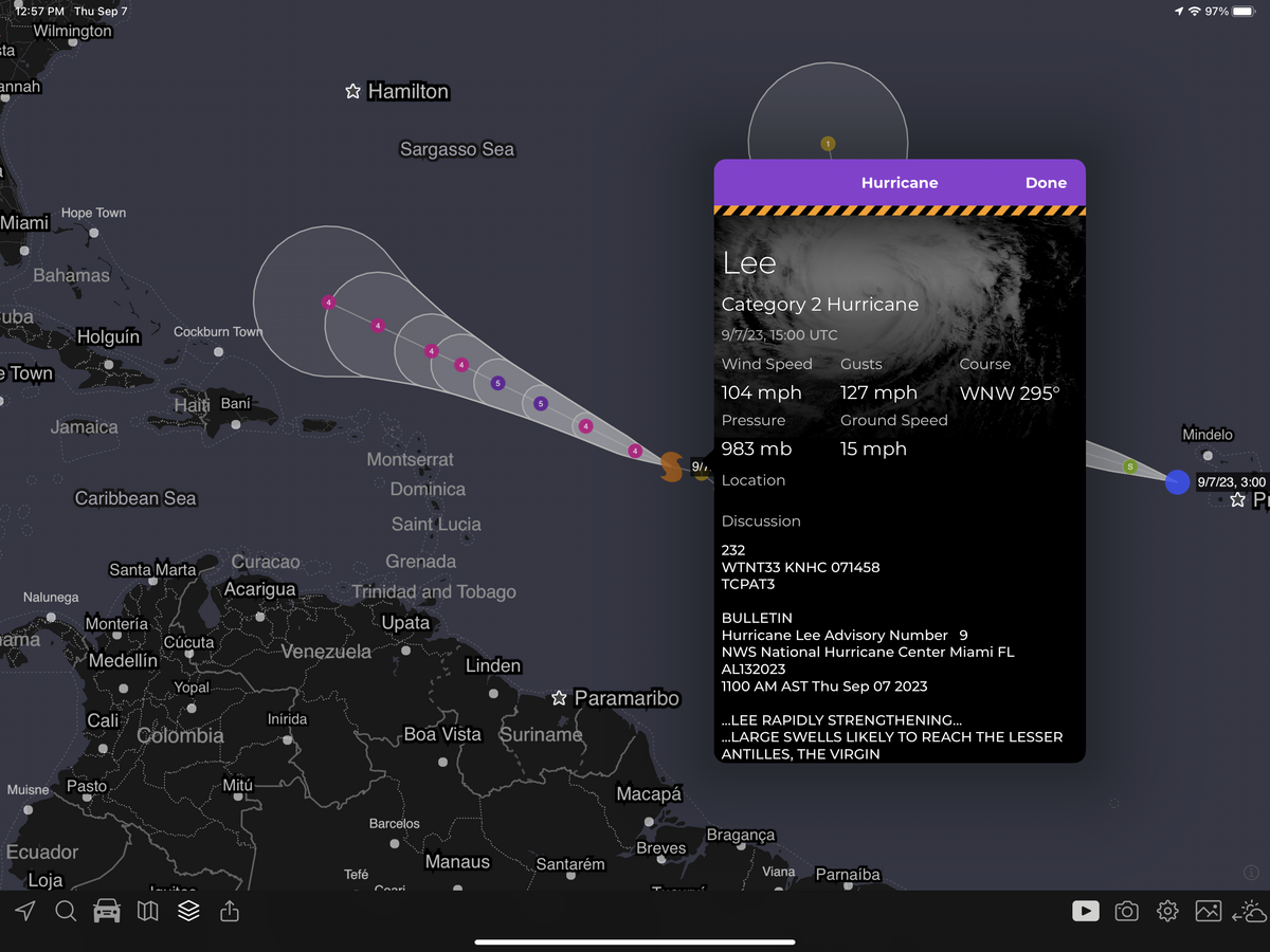
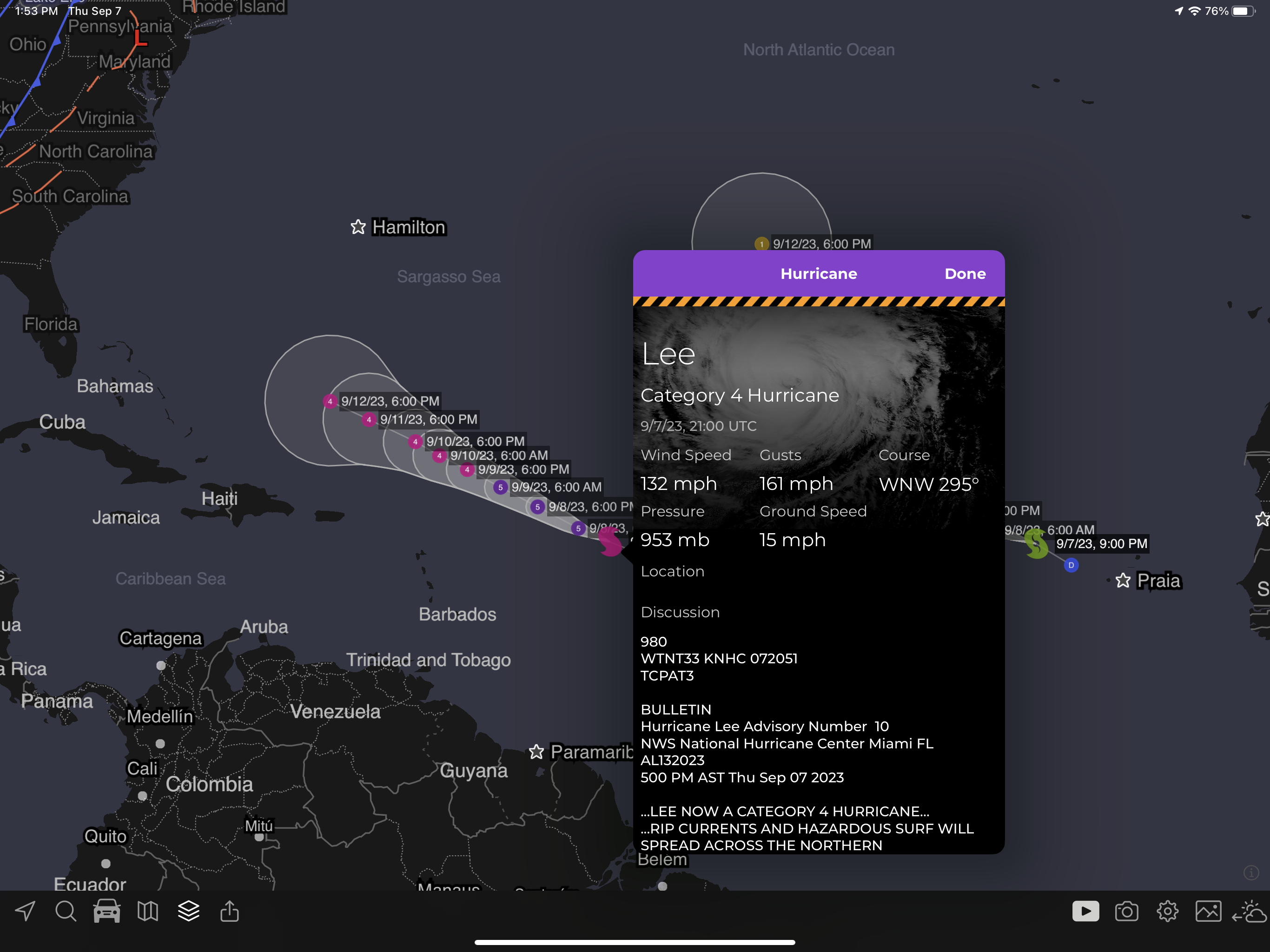
Just drop off the key, Lee
And get yourself free (from tropical storm status). Tropical storm Lee is out in the Atlantic and is going through rapid intensification (RI).
Peak winds are now forecasted at 160mph ~36-48 hours from now, which would put Lee at category 5. Here’s a bit more from the National Hurricane Center:
So we’ve got a strong storm, and some ideas on where it might go but it’s worth keeping an eye on.
“Oceanic heat content values will double along Lee’s track during the next 3 days,” the National Hurricane Center wrote late Wednesday.
For thereafter, meteorologists are closely evaluating the potential for any land impacts, with the greatest risk between Bermuda and the Canadian Maritimes. Lee’s long-term forecast track is uncomfortably close to eastern New England, which should continue monitoring the storm as shifts in its course are probable.
Source
And finally, before we move on, here’s a quick look at where Lee is now and its projected course.
The Weather Feed is a reader-supported publication. To receive new posts and support my work, consider becoming a free or paid subscriber.
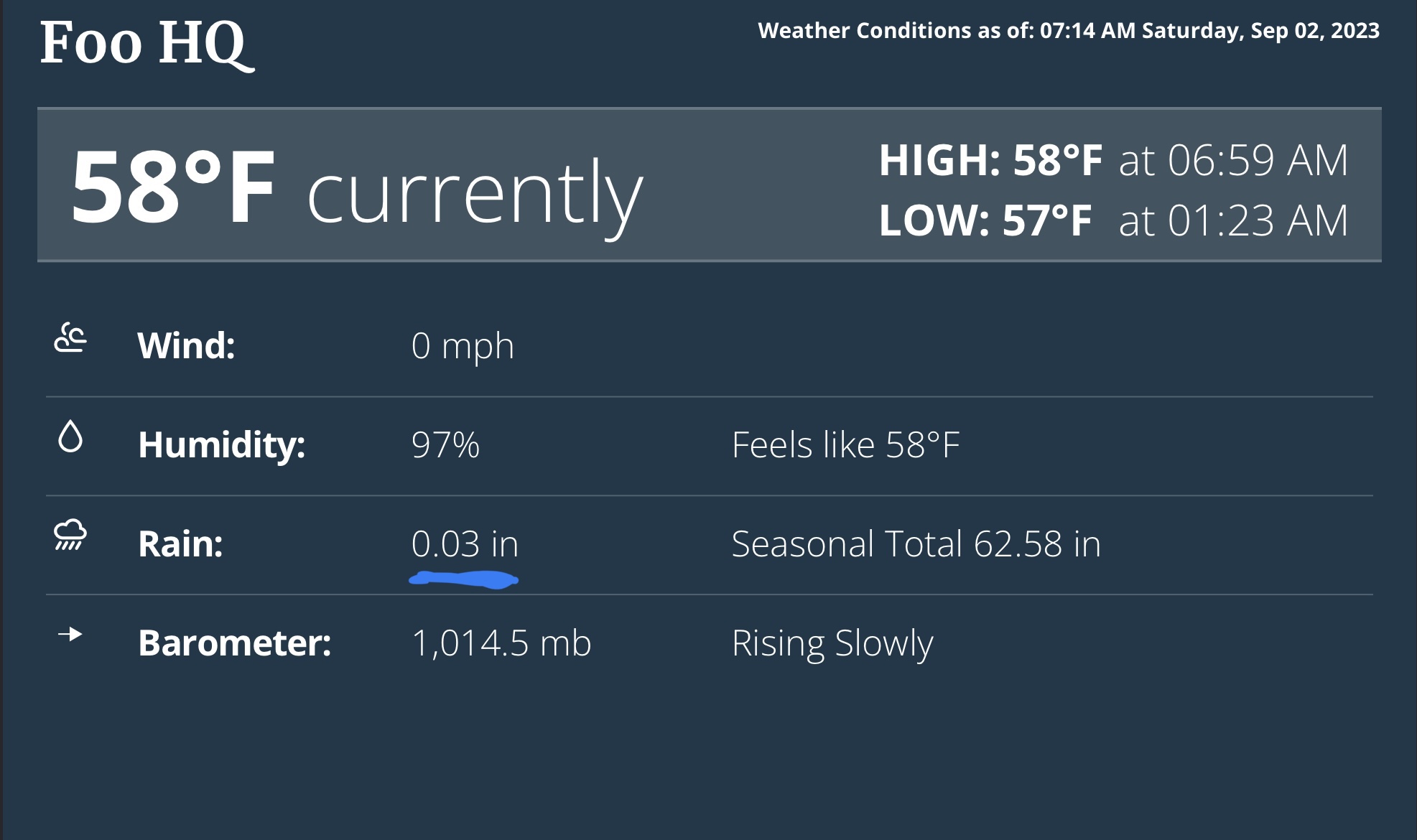
OK, it’s not big news
But we actually saw measurable rainfall over the holiday weekend. A modest .03 inches to be exact. Yay!
Hey, I remember that
A few posts ago, we touched on a marine heatwave west of California. Well, the WMO put out a post recently regarding these. The post and underlying study talk about the “why”, but I wanted to mention briefly one of the highlighted impacts:
Aside from ecosystems, ocean heat is an important fuel source for developing tropical cyclones. Marine heatwaves in the tropical Indian Ocean contribute to rapidly intensifying cyclones and fluctuations in the monsoon rainfall. Extreme warming in the tropical Atlantic could contribute to stronger storms, although the influence of El Niño on upper-level winds may counteract the effect of the warm surface temperatures.
Source
A real banger
I ran into this article while reading another Substack. It covers El Niño at a general level, but also as it applies to Australia. The graphics and descriptions are excellent, so if you haven’t taken the time to get a grasp on El Niño, now might be the time.
The article covers a lot but I wanted to touch on what it says about El Niño and climate change. Please join me on this quote journey.
From the observational instrumental record, which only goes back about 150 years, it’s hard to look at that record and say unambiguously that climate change has a fingerprint on it.”
That’s exactly what McPhaden and a group of researchers led by one of Australia’s foremost climate researchers, Wenju Cai, have been trying to do.
Earlier this year, they published a paper concluding that climate change was not only making the swings of the El Niño-La Niña cycle slightly larger, it was also making the biggest swings more frequent.
Here’s a bit more about that last piece.
What they found was only a small increase in the strength of the whole cycle — about 10 per cent — but enough to project that extreme El Niño events will happen twice as often this century as they did during the 1900s, and strong La Niña events will happen more often too.
“If you throw on a little more amplitude — you’re making the big events a little bit bigger — you’ve got this extra boost,” McPhaden says.
10% might not sound like a lot, but this visualization helps tell the story a bit more.
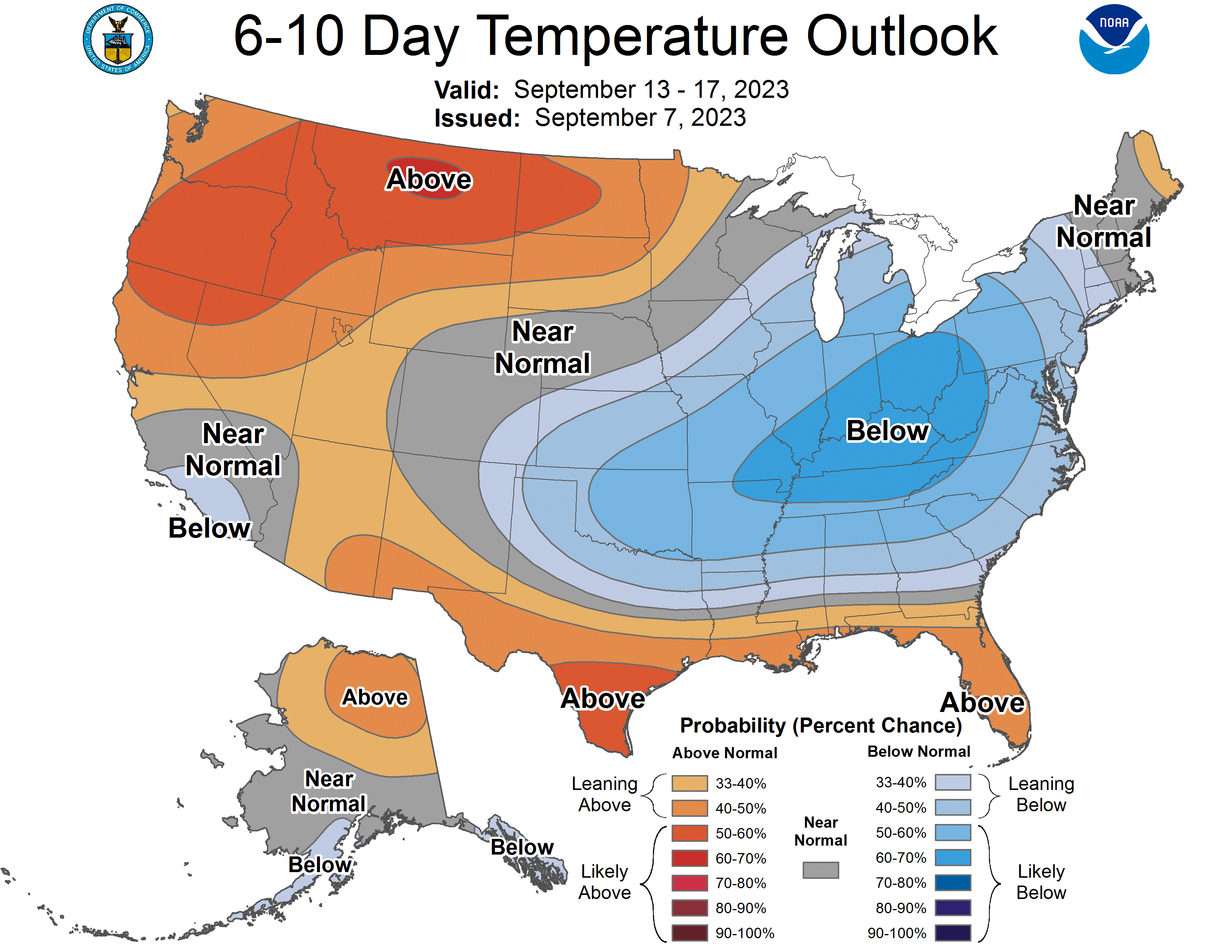
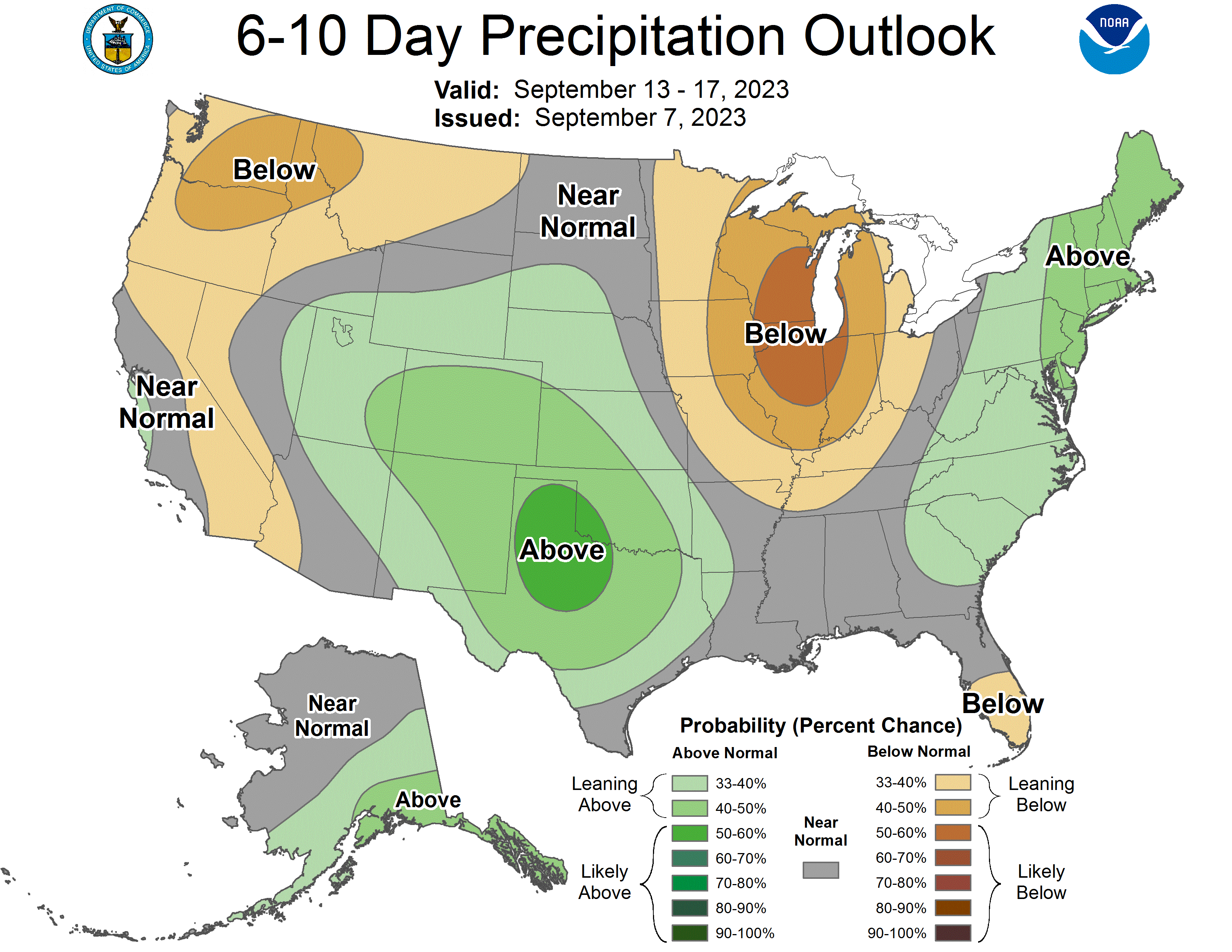
The usual
Here are your 6-10 precip and temp outlooks.
Cheers, Jimmy
I know Jimmy Buffet isn’t for everyone, but I’ve listened to his music regularly for most of my life (along with The Clash, Rancid, Roger Miller, and AC/DC). My high school friends used to tease me (in good humor) for listening to him and I remember defending him against their insults. I don’t know why I felt so defensive, it’s not like I knew him but it just seemed unfair.
Anyway, Jimmy Buffet passed away last week and I wanted to acknowledge and thank him. I know this is a weather newsletter, but I’m human and I have a heart. So here’s to you Jimmy 🥃, see you on the other side.
That’s it for now
See you next time weather fam 💙. I’ll leave you with some photos from last weekend.