Not that Ken
In which we do what we do best, learn some stuff and enjoy the weather.
I know, I’m so corny
We’re going to get the TIL (today I learned) portion of the newsletter out of the way early and talk about corn snow. It is indeed, a real thing:
Corn snow is made up of a thick layer of large melt-freeze grains that support the weight of skiers and riders while frozen. Melt-freeze snow grains get larger as they mature and start to take on a shape similar to corn.
Source: https://avalanche.org/avalanche-encyclopedia/snowpack/snow-metamorphism/melt-freeze-processes/corn-snow
Going to the movies
There’s been so much YouTube content lately that I haven’t been able to keep up. I’ll drop some highlights though.
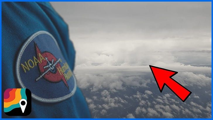
Last time we shared some footage from the Hurricane Hunters flying through Lee’s eye at category 5, and we’ve also mentioned Miss Piggy, one of their planes before. Matthew Cappucci got to ride with the Hurricane Hunters for MyRadar, and they put out a nice little piece. They actually got to see a double eyewall, which was something that satellite couldn’t pick up.
has been putting out a ton of footage lately. I particularly liked their cotton candy tornado, and the Weather Satellite 101 video.
And finally, this 7+ minute slideshow of 2023 storms from Jeff Frame. I don’t know that you could have a better last name to match this video.
Moving on to Weather West
We’ve got recent office hours and a blog post. What we don’t have are my notes, because I haven’t had a chance to watch them yet. I did read the blog post though so here’s my highlight/pick:
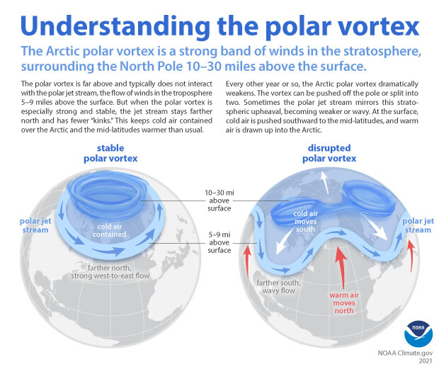
Overall, predictions of a strong to very strong El Niño event developing by late autumn appear to be bearing out–the Nino 3.4 region is now more than 1.5C warmer than average, which is generally considered to be the threshold for a strong event if sustained for a few months. But in addition to striking warmth in the eastern equatorial Pacific associated with this substantial and still strengthening event, there are also vast regions of remarkable non-tropical oceanic warmth elsewhere. In fact, record breaking (shattering?) marine heatwaves continue across both the North Pacific and North Atlantic as of this writing, and are not really expected to diminish greatly in the coming months. Thus, the current seasonal outlook involve El Niño event during Northern Hemisphere winter coincident with an extraordinary extent and magnitude of oceanic warmth in numerous other regions as well. That’s a global ocean configuration we’ve never seen before in recorded history, and definitely complicates the overall picture regarding what might happen with respect to Western U.S. hydroclimate in the coming months.
I know there’s still time left
But 2023 is looking to be the hottest year on record.
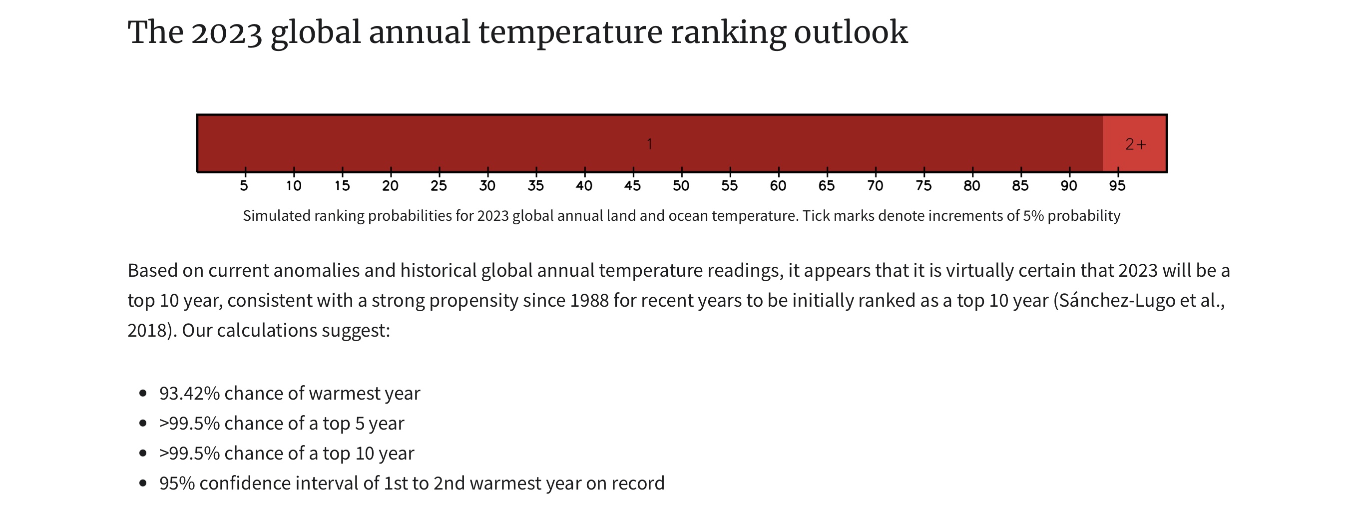
Berkeley Earth has some info on this too, as well as an August recap.
Whether you like it or not
Weather connects us all. I recently read The Weather Machine. I loved how much history the author covered in regard to weather observations and the beginnings of weather offices, bureaus, etc. I wanted to pull this one quote out though since it reminds of why I write this newsletter. The Jefferson here is Thomas Jefferson.
Yet Jefferson intuited a broader and more lasting point that has carried through until today: that the weather ties the world together.
From The Weather Machine, by Andrew Blum
Who the hell is Ken?
I don’t know, but they got a shoutout in a recent NWS Bay Area forecast discussion.
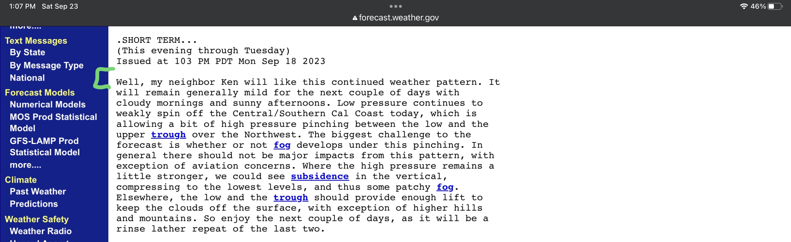
Whoever you are though Ken, I too liked that weather pattern.
The Weather Feed is a reader-supported publication. To receive new posts and support my work, consider becoming a free or paid subscriber.
Weather Underground
Nope, not that one, or that one. This one, where they looked into how underground hotspots could cause damage to buildings and such due to the ground expanding and contracting.
A new study of downtown Chicago shows how underground hotspots may threaten the very same structures that emit the heat in the first place: the temperature changes can make the ground expand and contract enough to cause damage. “Without [anyone] realizing it, the city of Chicago’s downtown was deforming,” says study author Alessandro F. Rotta Loria, a civil and environmental engineer at Northwestern University.
Source (Scientific American via Apple News): https://apple.news/ApggT5P1rRDi4sJq11rQSpA
Bloomberg Green
I don’t know but I guess it’s a thing. They published an article with some weather term definitions. I liked it because they used the terms in sentences, like so:
Scientists refer to deviations from the norm in terms of sigmas, as a way to standardize data and make it easier to compare and test hypotheses. Sigmas are the metric. You can take nearly anything that has a dataset—sea ice, apple harvests, home runs hit in a baseball season—and convert the number into sigmas. When it comes to climate change, there are a lot of new hypotheses to test. An event that falls within the one sigma range is pretty much normal. Reach two sigma and it’s an indicator that an event is odd but not notably so, while three sigma events are significantly beyond the bounds of normal. But something that’s a five or six sigma event is extremely rare.
Can you use it in a sentence? Abnormally warm air and water around Antarctica caused sea ice growth to stall, leaving a six-sigma-size hole in the ice pack.
Fill in the blanks: El N___
The section above from Weather West covers this too, but here are a few more articles if you want to read more:
- LA Times: El Niño is getting stronger, and odds are tilting toward another wet winter for California
- Super brief MyRadar video
It’s the bomb
A bomb cyclone that is. We talked about them before but I’m bringing them up now because we have one heading towards the Pacific NW.
Rainfall will peak on Monday, and by Tuesday, 1 to 3 inches will be common in western Washington state, Oregon and into Northern California, mainly to the north of the San Francisco Bay Area. Even higher rainfall totals are a good bet around coastal Canada.
The main culprit is a storm that will rapidly intensify to the south of the Gulf of Alaska. It is forecast to reach “bomb cyclone” status over the weekend before unleashing fury on the Pacific Northwest into next week. Additional rounds of rain are also probable later in the week.
Source (WaPo article via Apple News): https://apple.news/ARXOnvWlIRcCUkxYParn6eA
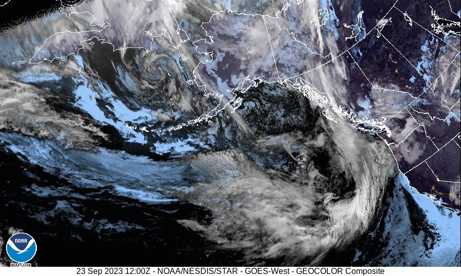
Let’s look at things from space because we can.
Happy (belated) Autumnal Equinox
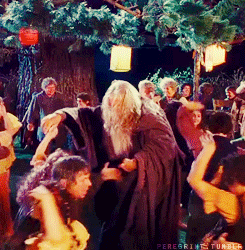
And happy birthday Bilbo and Frodo! September 22nd was the happy day.
I think we’ll call it there
See you next time weather fam 💙
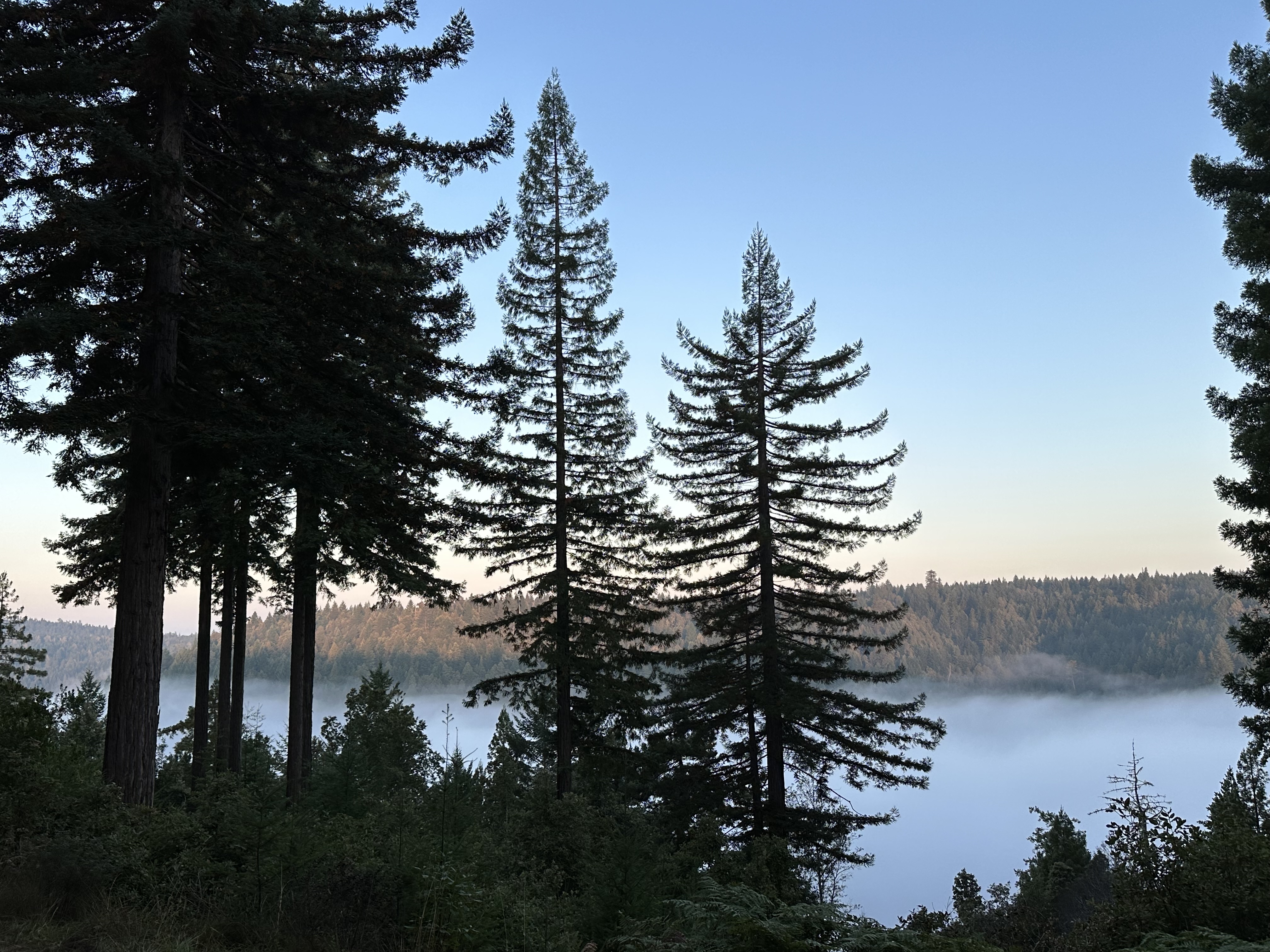
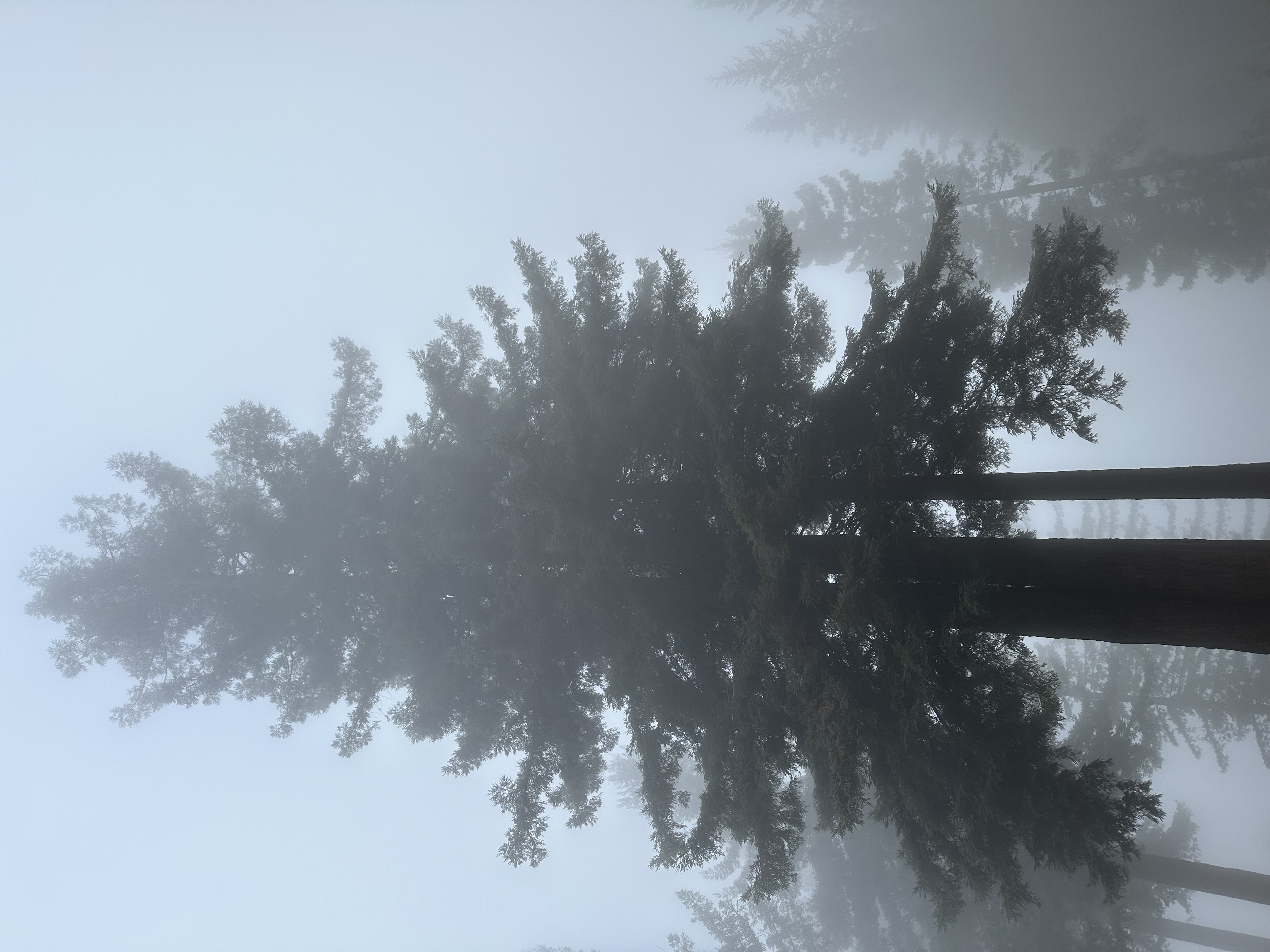
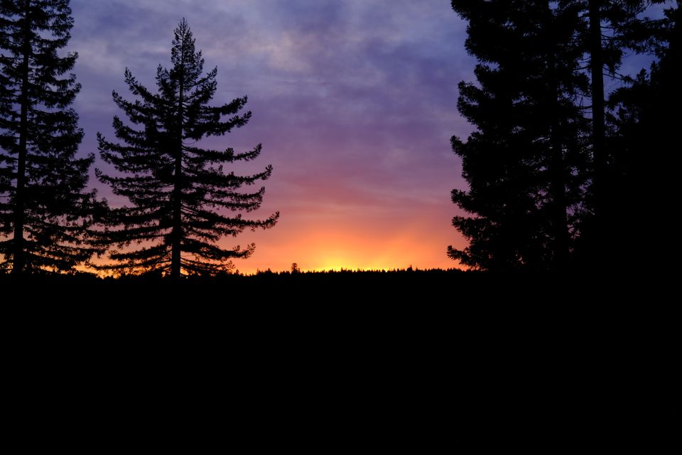
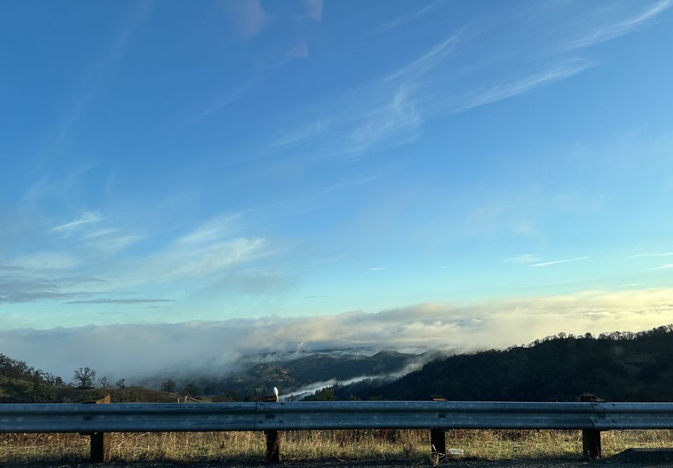
I’ll leave you with some fog in the canyon, and a fog + smoke enveloped redwood.
The Weather Feed is a reader-supported publication. To receive new posts and support my work, consider becoming a free or paid subscriber.