Buckle up, we’re going to rapidly intensify
In which we cut to the chase, talk about rats, and meet a new friend.

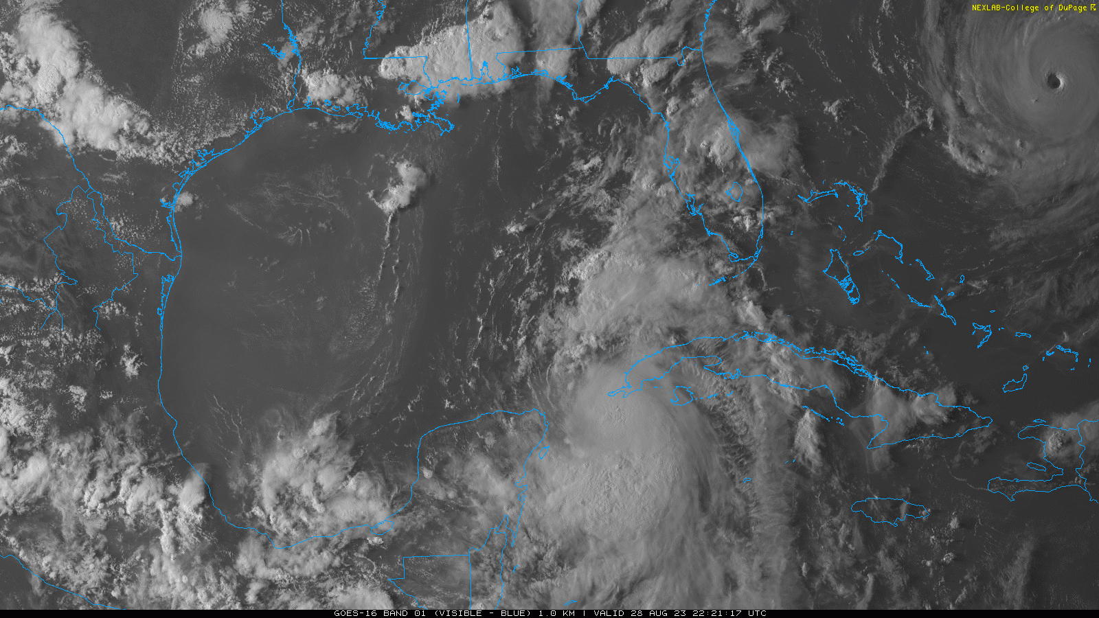
Hurricane Idalia
First up, let’s see where it’s at. Here’s a short infrared satellite loop where we can see the giant red blob growing.
And another brief look before it starts getting dark out on the East coast.
Now, let’s look at where Idalia is expected to go. Here’s the latest cone graphic showing landfall on Wednesday.
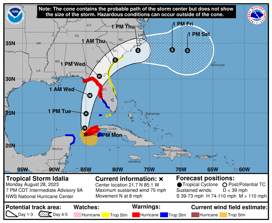
recently published an update on Idalia. I suggest you read through that if you want a detailed update, but here’s a bit more on the forecasted track.
The track forecast continues to be tightly focused on a path towards the eastern Panhandle and northern Nature Coast. With Idalia now embedded in a narrow channel of steering winds between high pressure to the west and a dip in the jet stream to its north, we’re unlikely to see huge leaps in the projected track. Accounting for a mid-day nudge westward with 12z track guidance, the most probable landfall range is between Alligator Point and Crystal River, likely Wednesday morning or early afternoon. As always, adjustments in the forecast track are likely over the next 36 hours, but don’t bank on an 11th-hour reprieve if you’re in the projected path of Idalia.
Source
Or if you’d rather watch an update, MyRadar has you covered.
The storm is currently forecasted to hit category three, although after reading/watching some updates, it sounds like category four isn’t out of the question. So, we’ll see what happens.
You might want to skip this…
If you’re like Henry Jones in The Last Crusade (hint: he doesn’t like 🐀).
Climate change has wide-ranging impacts. That’s nothing new, but something I hadn’t thought of was the impact that warmer winters have on the rodent breeding season. Say for rats in, oh I dunno, New York. Warmer winters aren’t the only contributor to rat populations there, but they do have an impact.
While the origin story of the rats remains elusive, why they have been able to persist is quite clear. Warmer winters have extended rodent breeding cycles. And too many buildings have too few garbage cans for their size. “You have a lot of really big buildings that have inadequate garbage storage,” Bragdon said.
Source
The Weather Feed is a reader-supported publication. To receive new posts and support my work, consider becoming a free or paid subscriber.
So is it good or bad?
There’s been a marine heat wave off the California coast since around 2014. This blob sometimes moves closer to the coast, which obviously impacts the water temps and weather. This heat wave also recently contributed to hurricane Hilary.
For the most part, the northwesterly winds that blow along the United States' Pacific Coast have worked to keep the heat wave offshore — keeping the near coastal waters cool as the deep, nutrient-rich waters of the eastern Pacific churn upward as the planet spins.
But now, when they die down or lose strength — which they occasionally do, especially in the late summer to fall — the marine heat wave moves in.
Source
What’s of additional interest is what, if any, relationship there will be between this blob and the developing El Niño.
But Josh Willis, at NASA's Jet Propulsion Laboratory, said that while these systems occupy the same ocean, it's not clear the El Niño will do much to change the pattern of the heat waves in the North Pacific, or vice versa.
That's because the El Niño is an ocean pattern, while the heat waves are atmospheric — defined by sea surface temperature anomalies detected by satellites.
What is clear, he said, is that climate change is warming the planet, leading to overall warmer temperatures that are likely to have an effect on both the El Niño and the heat waves.
Grab your sled, skis, snowboard, etc.
And head to Chile I guess. Some areas have seen around 250cm (~8.2 feet) in the last week or so. I couldn’t find the original source but this company called Powder Quest reported these totals on social media (I think it was Instagram).
Las Lenas, Argentina: 11-13 feet (3.3-4 metres)
Portillo, Chile: 8.2 feet (2.5 metres)
Valle Nevado, Chile: 6 feet (1.8 metres)
Cerro Catedral, Argentina: 4 feet (1.2 metres)
Source
I guess it’s time to find an official site for looking up precipitation totals across the globe.
Cut to the chase
We covered hurricane Hilary quite a bit in the last few newsletters. I think the last thing I want to briefly touch on relates to the question about whether to expect more storms like Hilary.
This kind of storm is unusual for California, and it will probably remain a rare occurrence. Even so, strange and extreme weather is a hallmark of climate change. And experts say it could have more curveballs in store that the state should be preparing for.
“There probably will not be a whole lot more [hurricanes that move into the southwestern US] in the future. But when they do happen, they’ll be much more like Hilary,” says David Easterling, chief of the Climate Assessments Section and director of the National Climate Assessment Technical Support Unit at NOAA’s National Centers for Environmental Information.
Source
Just wow
There were some pretty severe storms and tornados in Michigan recently. Vehicles were flipped, power was knocked out, etc. The satellite imagery though is what I wanted to show. This is from the Cooperative Institute for Research in the Atmosphere , part of Colorado Sate University. They have a stellar library of videos.
Going international
The Weather Prediction Center does sort of what you think it’d do.
WPC's Mission:
To synthesize the nation's daily weather story and champion the operational prediction of rain storms, winter storms, and extreme temperature events for the protection of life and property.
Source
But you maybe didn’t know that within the WPC, there’s an international desk that coordinates with other countries. Its formation was triggered by a strong La Niña event in 1988 that was causing extreme drought in South America. MyRadar recently did some interviews with members of the international desk, which I thought was pretty cool.
Daniel Swain’s latest office hours
Recorded earlier today. It was actually an hour this time and touched on a few things: recapped Hilary, fire season in the west, record heat waves, El Niño, and hurricane Idalia. My key mentions are:
- Rain in SoCal has helped mitigate fire season a bit, not much help for central and NorCal
- West coast waters are starting to warm up
- El Niño is still strengthening, it’ll be interesting to see if the generally warm oceans across the globe have an impact on El Niño
That’s it fam 💙
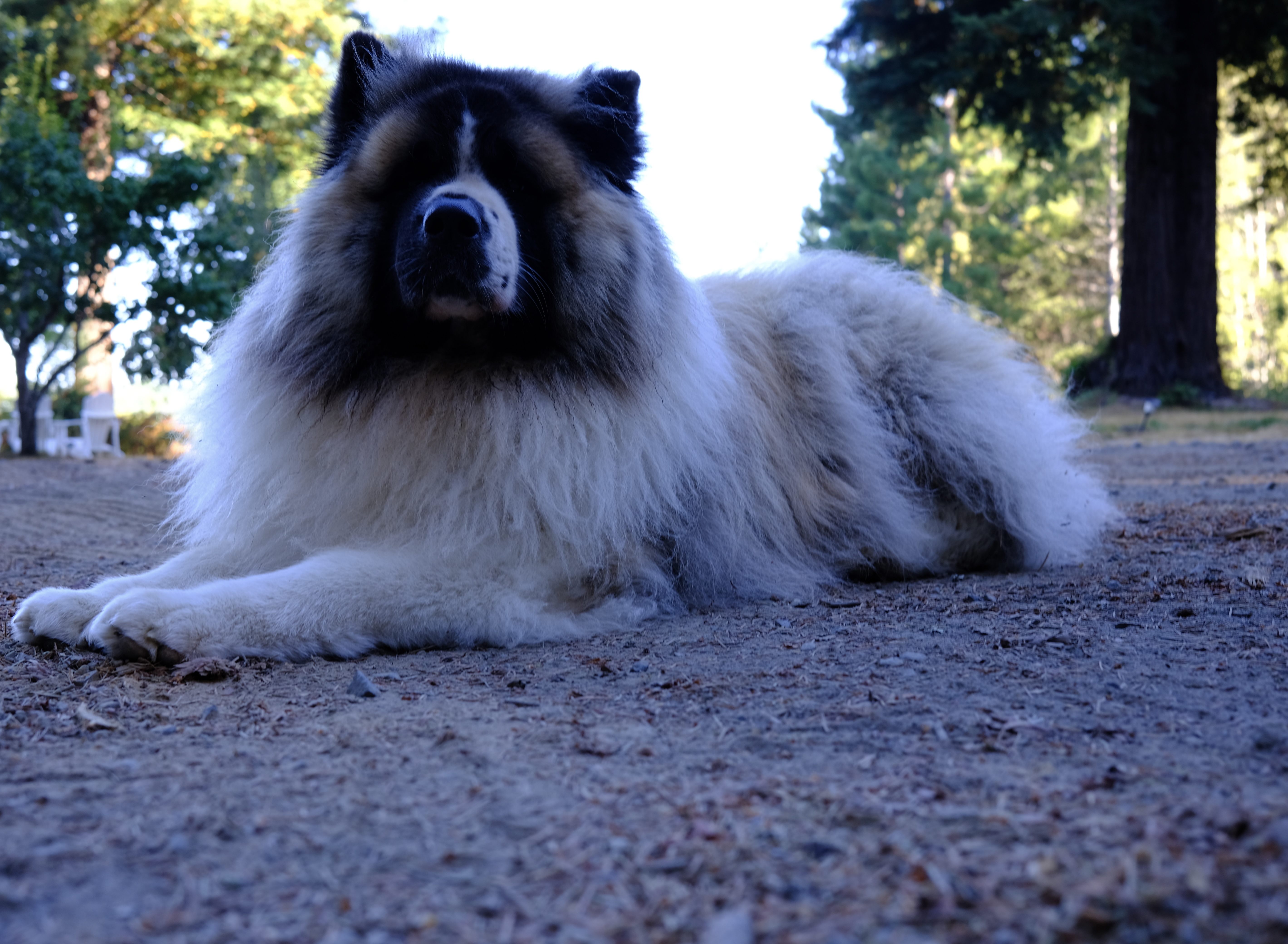
See you next time! If you’re anywhere near Idlia’s path, please stay safe! I’m going to leave you with a different sort of photo this time. If you haven’t met him, this is Sancho and he’s an absolute weather unit. Here he is blocking the sun.