You got me hooked
In true Weather Feed fashion, we have a little fun and learn a few things.
I wanted to take a quick second to say welcome to the new subscribers! It’s awesome having you here and I hope you enjoy the newsletter 💙.
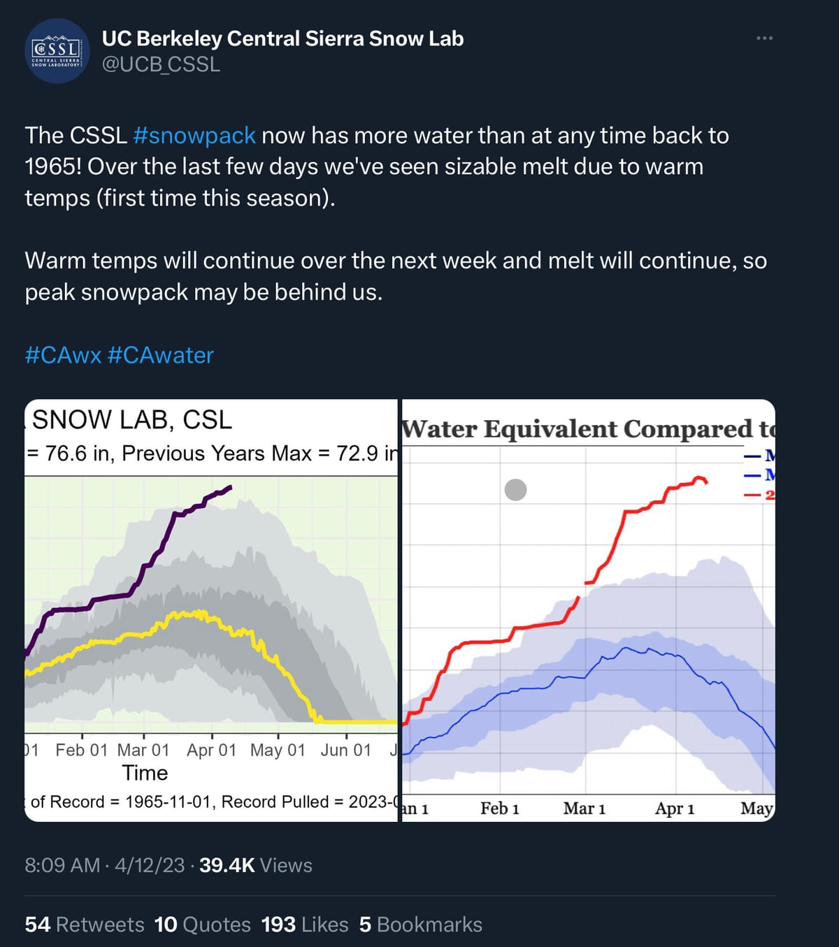
The snowpack melteth
There has been a bit of melting, but a majority of the snowpack is still in place so the concerns are still ahead of us (or on Apple News).

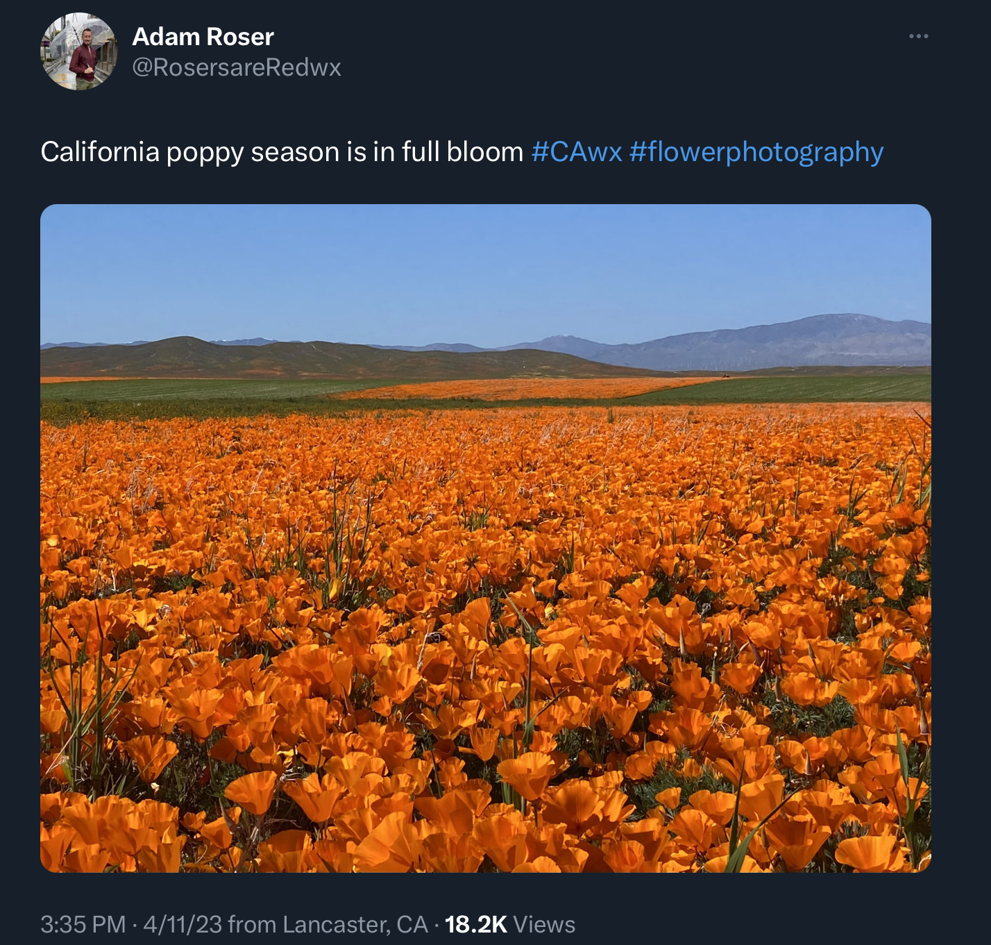
You get a poppy, and you get a poppy
Tis the season!
Looking ahead
In 2024, we should see some adjustments to the hazard messaging system the NWS uses. We’ve covered hazard messaging a few times before (here too). You can read more about the project, but the general idea is to make the messaging simpler by reducing the number of hazards and reworking their text. I’m looking forward to it but… I’m also a technical writer so I guess that makes sense.
The Future of Rain
I know this sounds like a documentary that should be narrated by David Attenborough, but it’s a bit different than that. Daniel Swain did a webinar about this topic. It’s about an hour long though so you might want to grab a snack if you watch it. I’m only part way through but I thought I’d share.
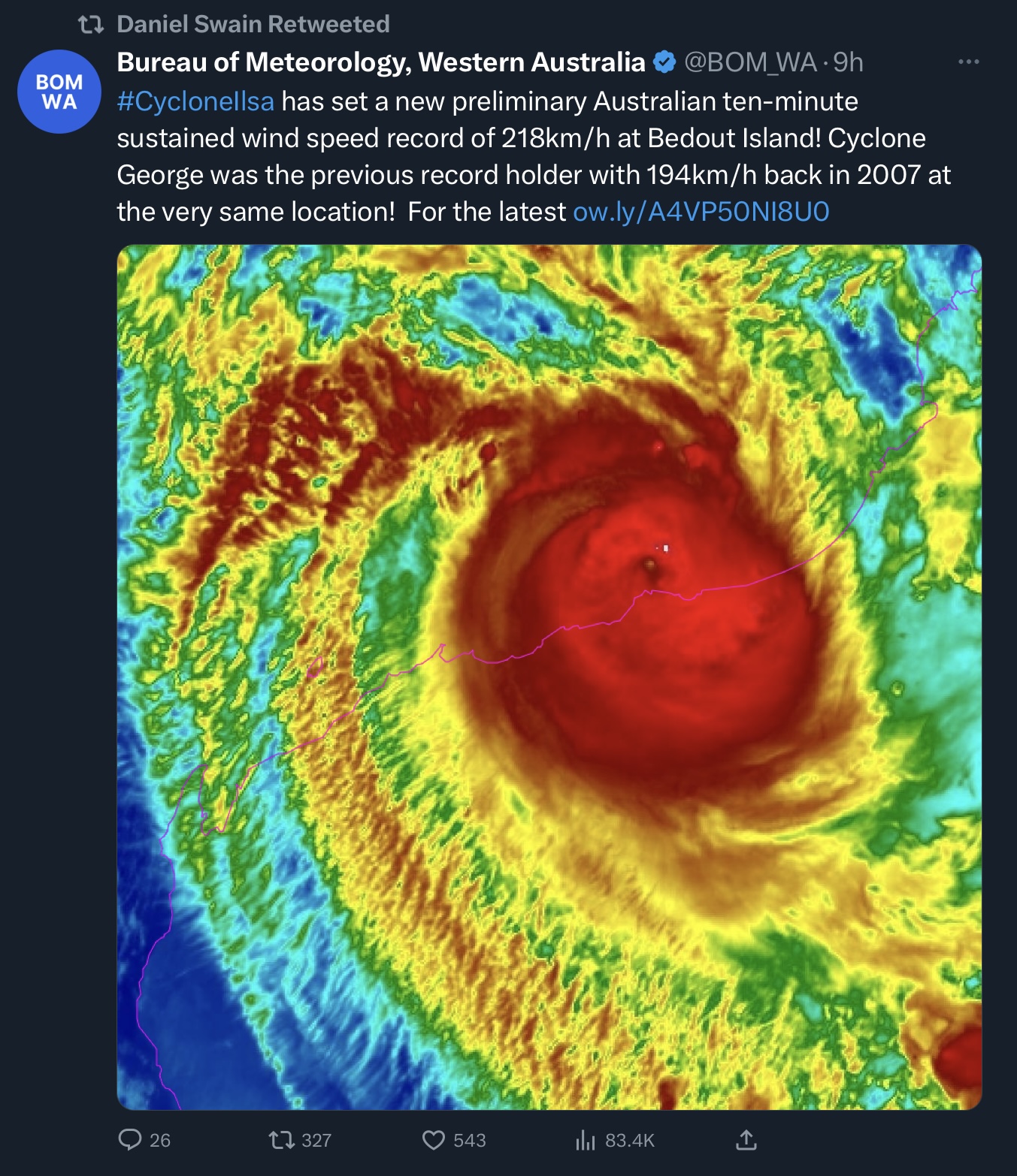
Cyclone Ilsa
This is spinning itself up out near Australia. Here’s a video if you want a breakdown (this was from yesterday).
And then today…
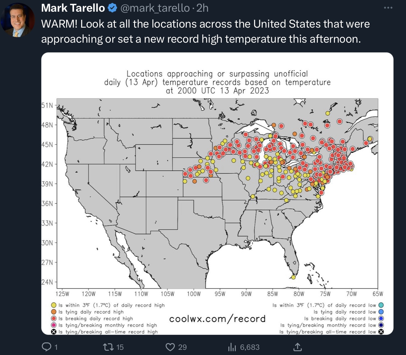
Throw’em the heater
A heat dome (to put it simply), is when a high pressure system traps warm air over a certain area. One got rolling the other day. Heat domes can sometimes cause heat waves, and they can also increase fire danger so we’ll be keeping an eye on this one. Here’s a quick look at some of the records and almost records from this recent heat dome.
Weather Feed is a reader-supported publication. To receive new posts and support my work, consider becoming a free or paid subscriber.
A hook what?
Oh yay, we’re going to learn some more!
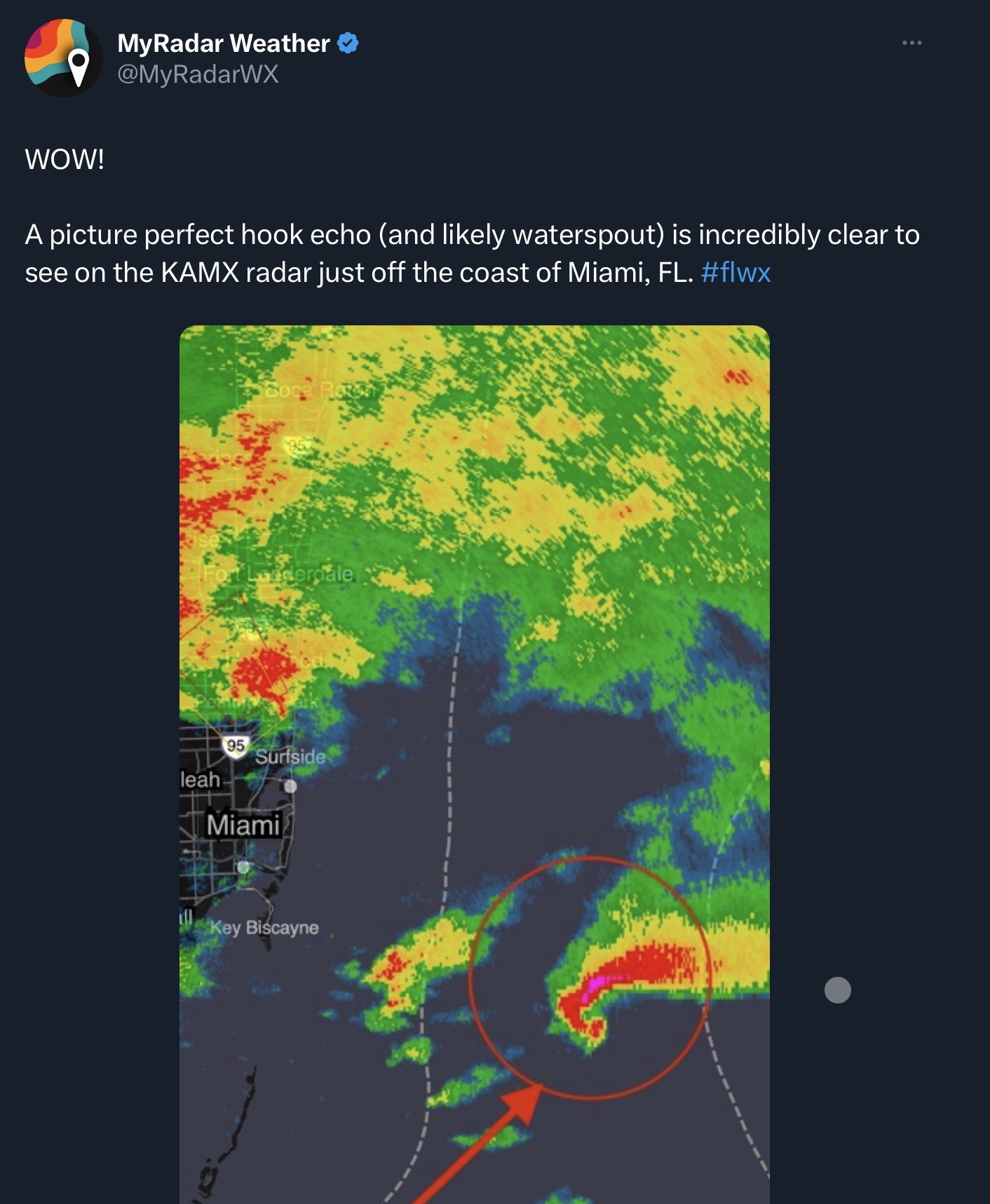
Hook echoes are patterns you can see on radar images, and they often indicate mesocyclones (a larger region of rotation than a tornado) and favorable conditions for tornadoes (read more over here). They usually show up on the right-rear side of the storm.
Meanwhile, also in Florida…
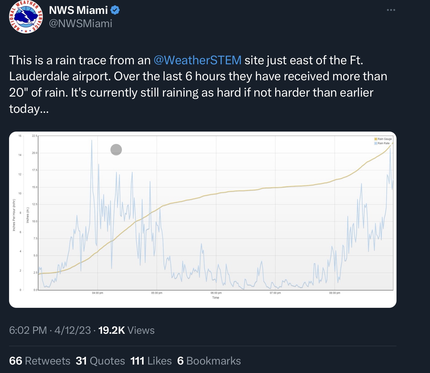
Here’s a neat radar loop of the storm. Oh, and here’s another animation. Too bad I can’t embed tweets so you could just watch it here. Imagine that!
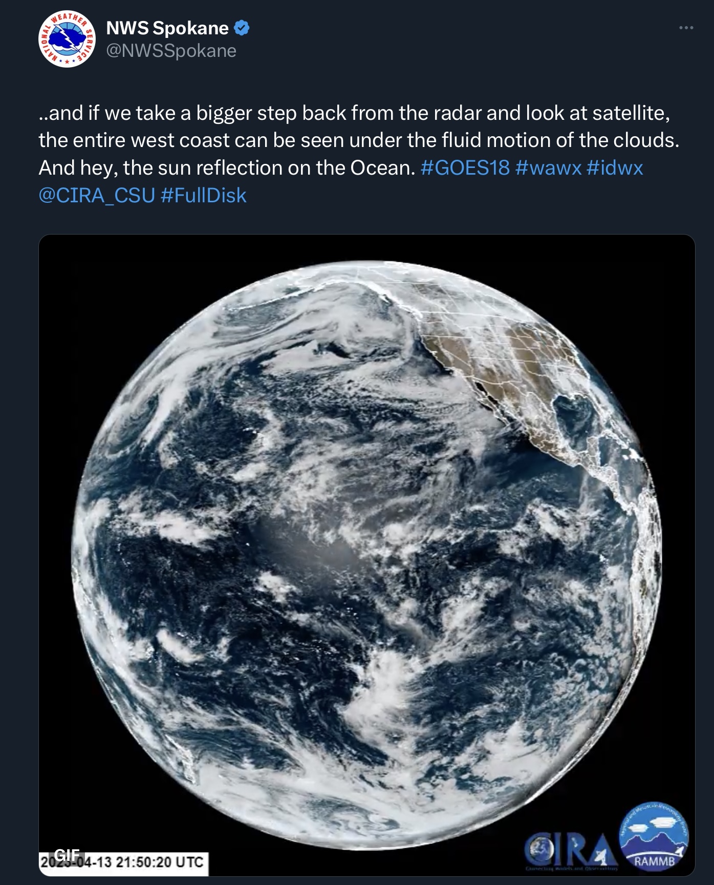
This was a new one for me
Seeing the reflection of the sun off the ocean… from space!
I know you knew it was coming
An El Niño watch has been issued fam.
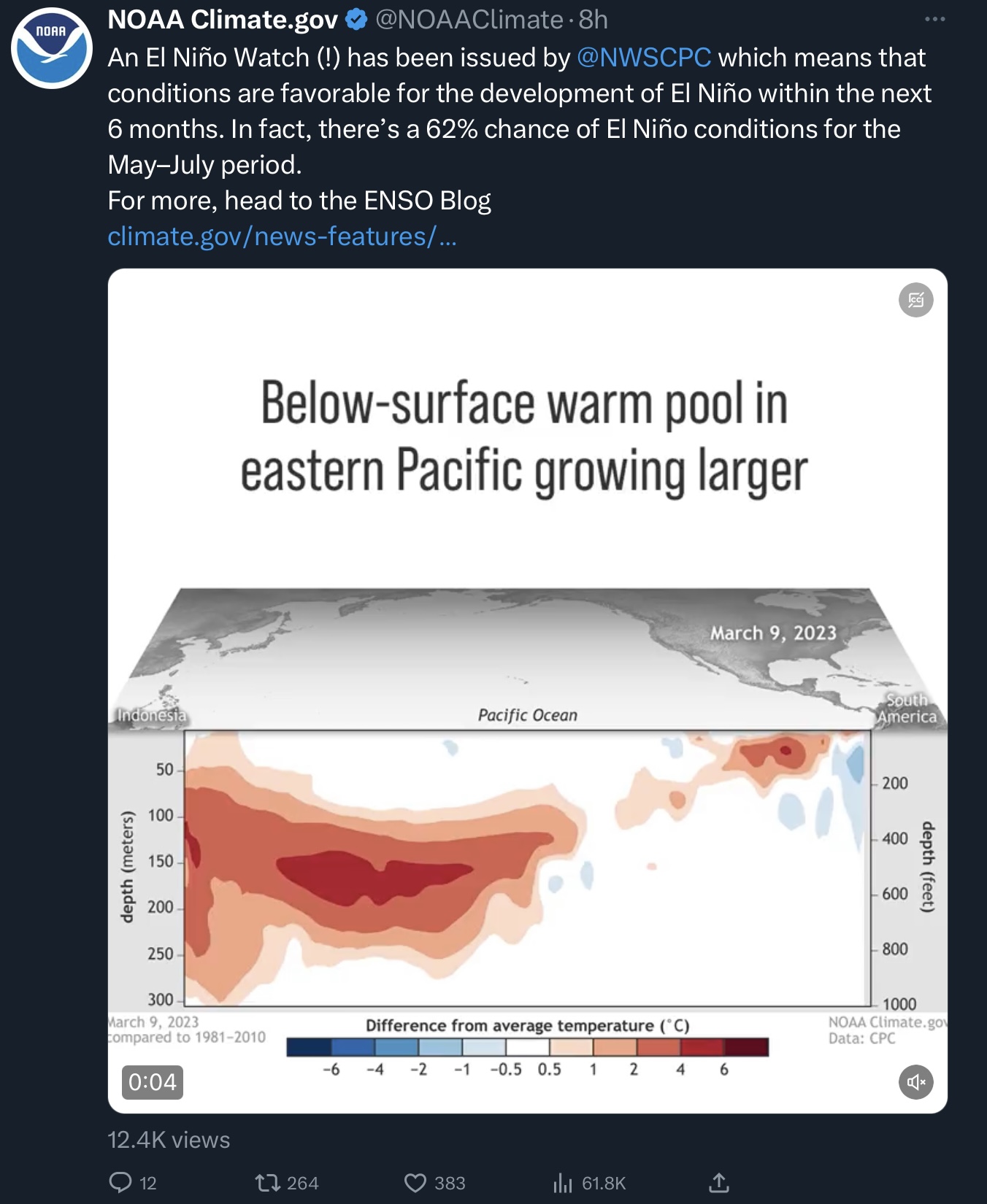
So now that we’re watching for it, the big question is how strong it will be. The short answer is that they aren’t super sure yet.
March’s Global Climate Report
That’s right, it’s already time for the next report. They honestly do a good job of giving you the bullet points, so I won’t rehash them here at length. I will note that it was warm in a lot of places, with one of the exceptions being the Western U.S., and we officially moved out of a La Niña pattern.
See you next time weather fam