We made it, it’s the weekend
In which pigs fly and we celebrate fall.

2 for 1
Idalia made landfall on Wednesday morning. It briefly hit category 4 before going back down to 3 and then making landfall in Florida. In the video below, you can see Idalia and Franklin (yes, Franklin is still there) spinning along together.
Credit to The Cooperative Institute for Research in the Atmosphere at Colorado State and the National Oceanic and Atmospheric Administration (CSU/CIRA & NOAA). Video link if you want it.
If you want a detailed breakdown for Wednesday, you can check out WeatherTiger’s live blog.
One thing I wanted to call out was that if you compare where Idalia made landfall with the cone we shared last time, it looks pretty dang close. Overall, it seems like the forecasting was pretty solid.
When Miss Piggy Flies
You likely know already that people fly planes into hurricanes for science. But did you know that NOAA has a plane called Miss Piggy? It flew into Idalia several times but had to be grounded for repairs. And also, this:
Aside from Miss Piggy, NOAA operates another Lockheed WP-3D Orion called Kermit and a Gulfstream IV-SP named Gonzo.
There’s also a pretty neat video + article on CNN that covers being inside the plane while flying through Idalia. They actually went through it when it was a category 4!
If you’re looking for more (Atlantic) hurricane season coverage, check out this MyRadar update or WeatherTiger’s latest.
The Weather Feed is a reader-supported publication. To receive new posts and support my work, consider becoming a free or paid subscriber.
Happy Meteorological Fall 🍁
That’s right, if you’re in the northern hemisphere, today is the first day of meteorological fall.
Meteorologists and climatologists break the seasons down into groupings of three months based on the annual temperature cycle as well as our calendar
Our high today was 71 so it felt a bit fall-ish which I’m down with.
What’s your threshold?
A recent study has taken another look at how climate change impacts wildfires, particularly in California. It confirms some previous research, but looked into wildfire thresholds.
The team found there were critical thresholds governing fire behavior. For fires burning near the thresholds, climate change could tip them into a more dangerous state.
Source
Here’s a bit more detail on those thresholds. I kept the third paragraph in there because it’s important to note that the hot atmosphere isn’t the only contributor to intense wildfires.
The thresholds were primarily associated with the vapor pressure deficit, a fancy term for how air pulls water out of dead or live plants and other burnable materials. Hotter air –one of the hallmarks of human-caused climate change–sucks moisture more strongly out of those pieces of potential tinder. Years of prior research has shown that fires can grow much bigger and more intense when they have plenty of dry, crispy fuel to burn, a factor heavily influenced by big vapor pressure deficits.
The new research substantiates those earlier findings, showing fires to be nearly five times likely to burn explosively if those thresholds were crossed. But when the weather was already extremely hot and dry, or by contrast very moist, climate change’s extra nudge didn’t make as big a difference to fire behavior.
As much influence as a heated-up atmosphere can have, it’s far from the only factor at play. “Explosive growth of fires is almost always in some way correlated with high winds,” which whips small fires into enormous ones, points out Max Moritz, a fire expert at the University of California, Santa Barbara, who wasn’t involved in the study.
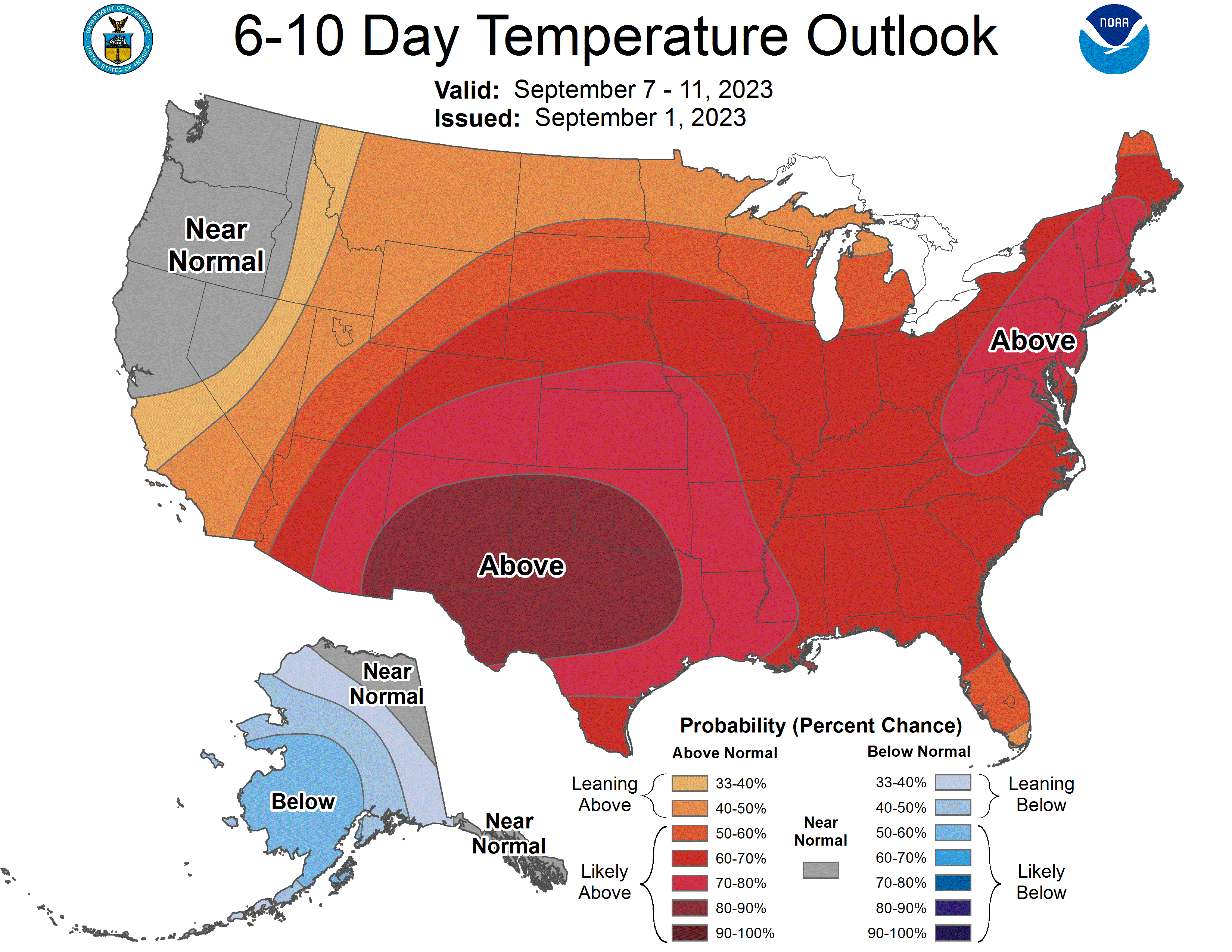
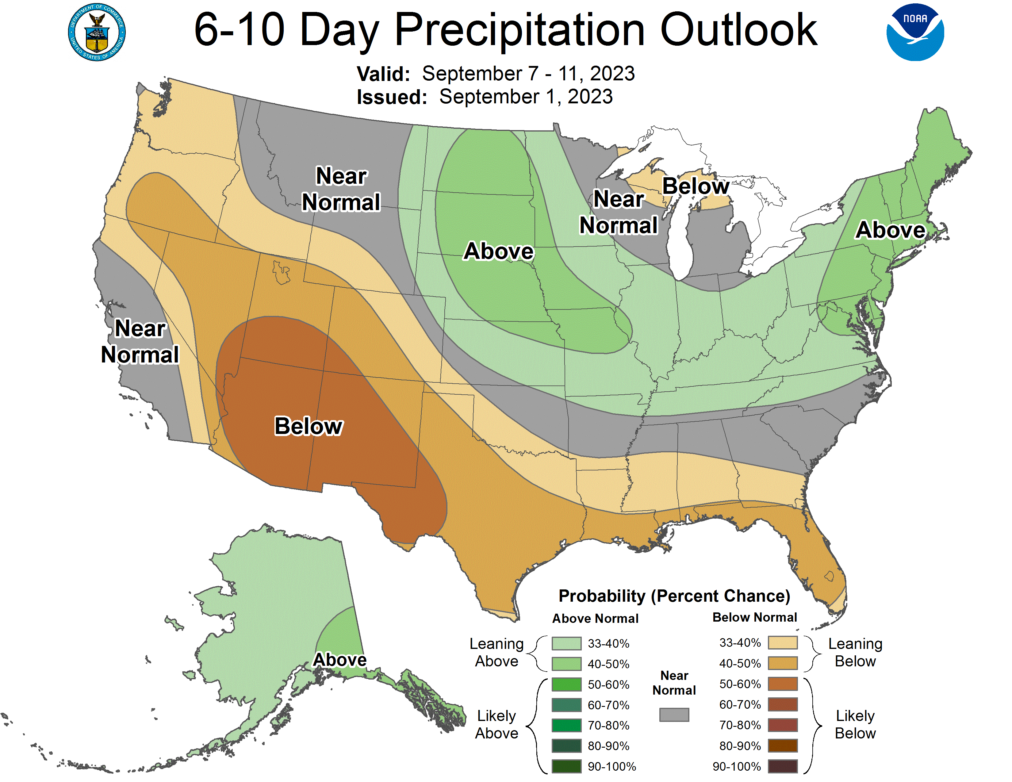
Lookin’ ahead
Here are the 6-10 temp and precip outlooks for the U.S.
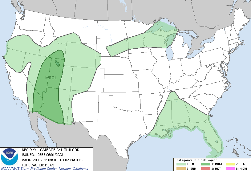
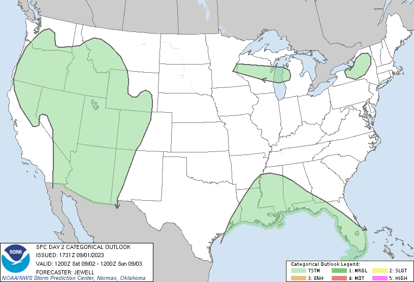
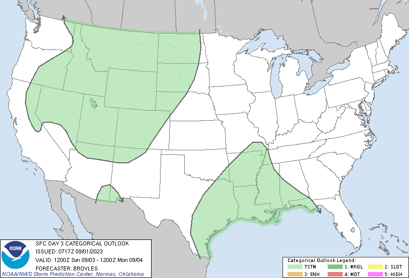
And for the nearer future, the convective outlooks for the next few days.
That’s it
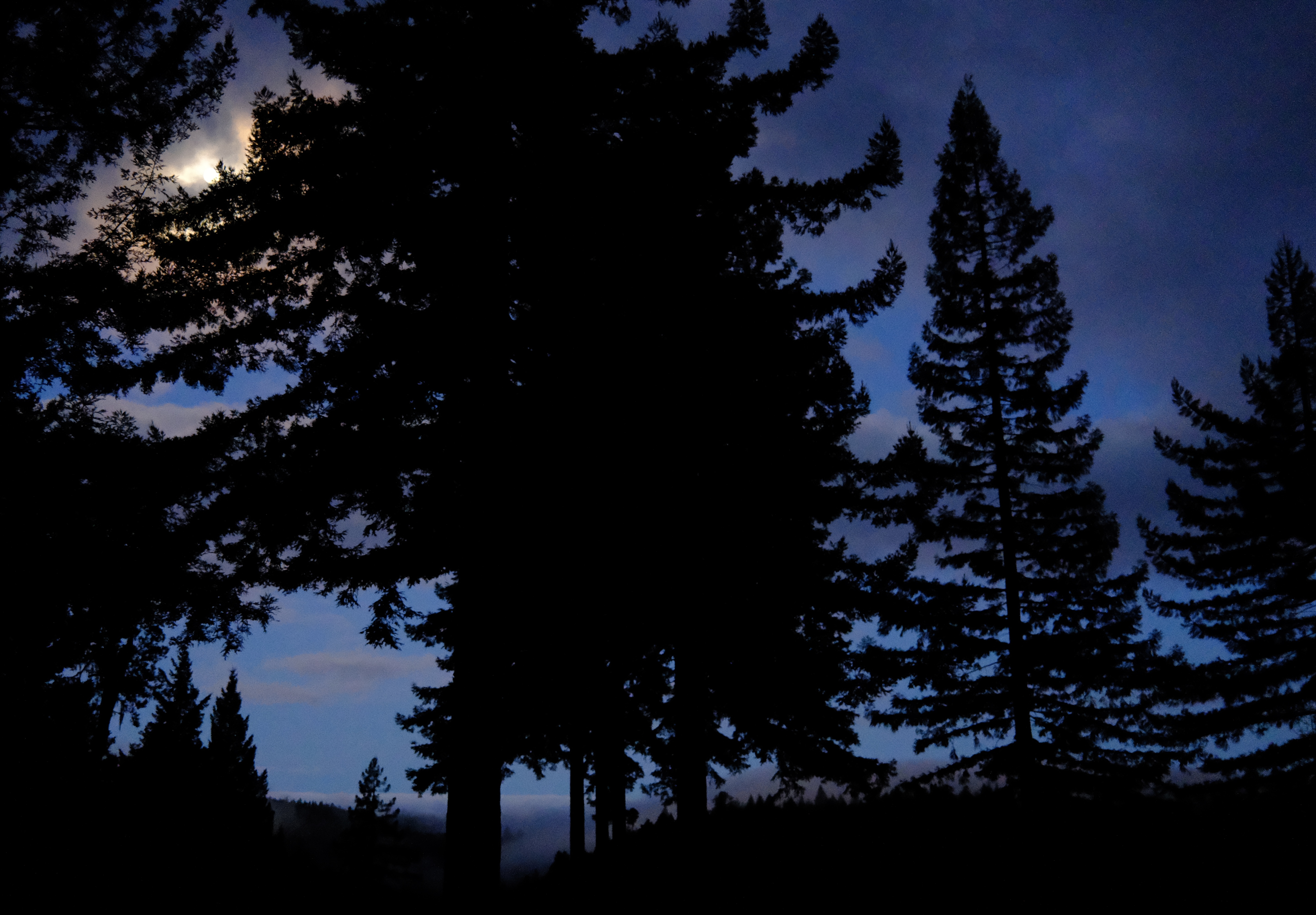
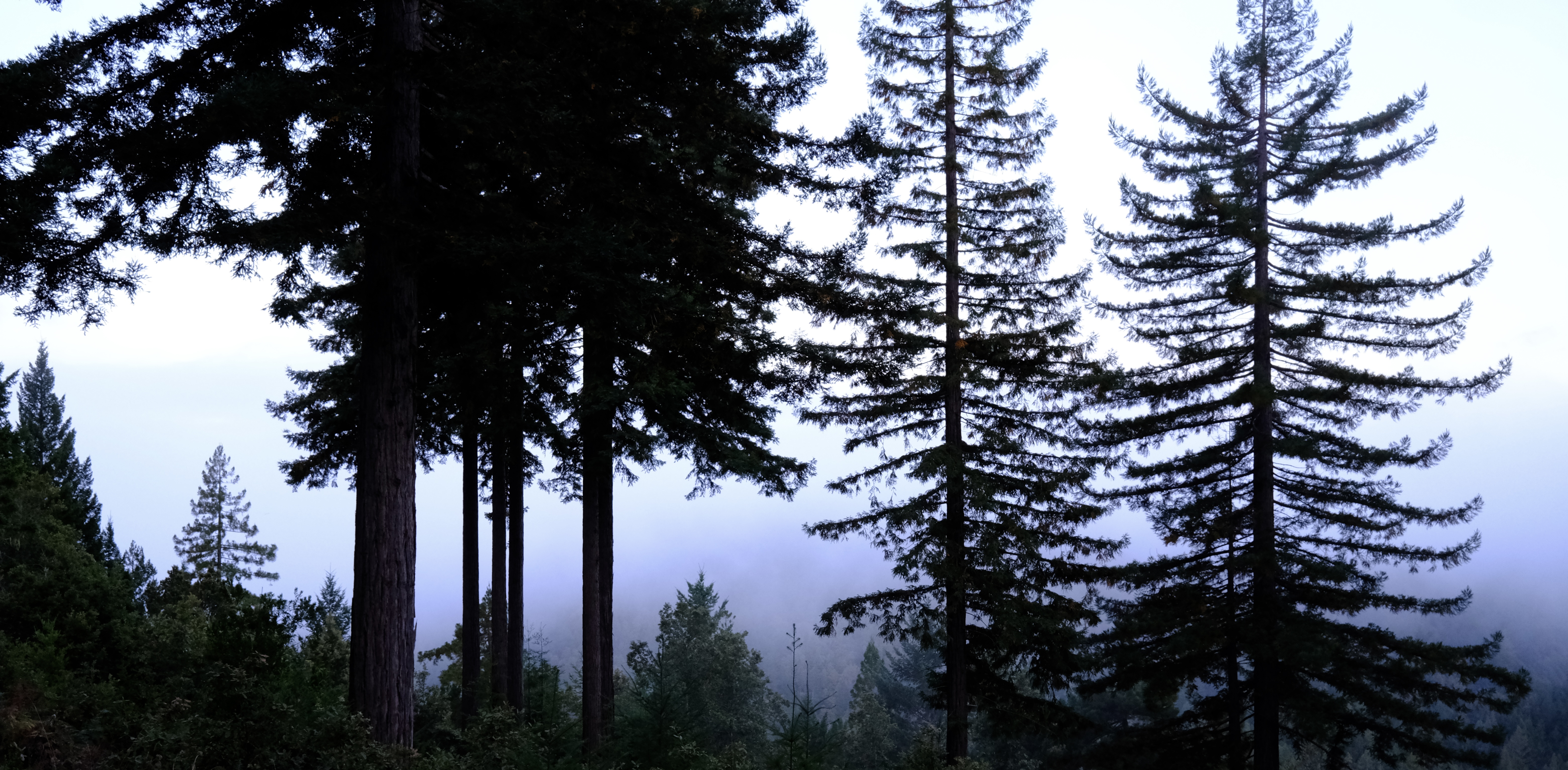
Congratulations on making it to the weekend fam. I’ll leave you with some photos of the foggy moon photos.