My biscuits are burning
In which we get a bigger bat and put on some sunscreen.

Heatin’ up
We’ve been watching out for El Niño for a bit now and things are heating up pretty quickly. Daniel Swain covered this and a few other things in a recent blog post. In regard to El Niño and the models, Swain wrote:
What do the models say? Most are now predicting an El Niño event ranging from moderate to strong (or even record-breaking) magnitude, peaking late next autumn or early next winter. There’s still a wide range of outcomes possible at this early juncture, but as the median outcome is getting close to “strong El Niño,” I do think it’s worth having this conversation now. If this happens, there will be significant implications for California weather beginning around mid-summer (when the presently unusually *cold* ocean temperatures may rapidly shift to unusually *warm*, disrupting what will otherwise likely be a robust coastal marine layer in May/early June, and raising the likelihood of coastal humid heatwaves) and then through next autumn and winter (it would likely increase the odds of an unusually wet season next Water Year).
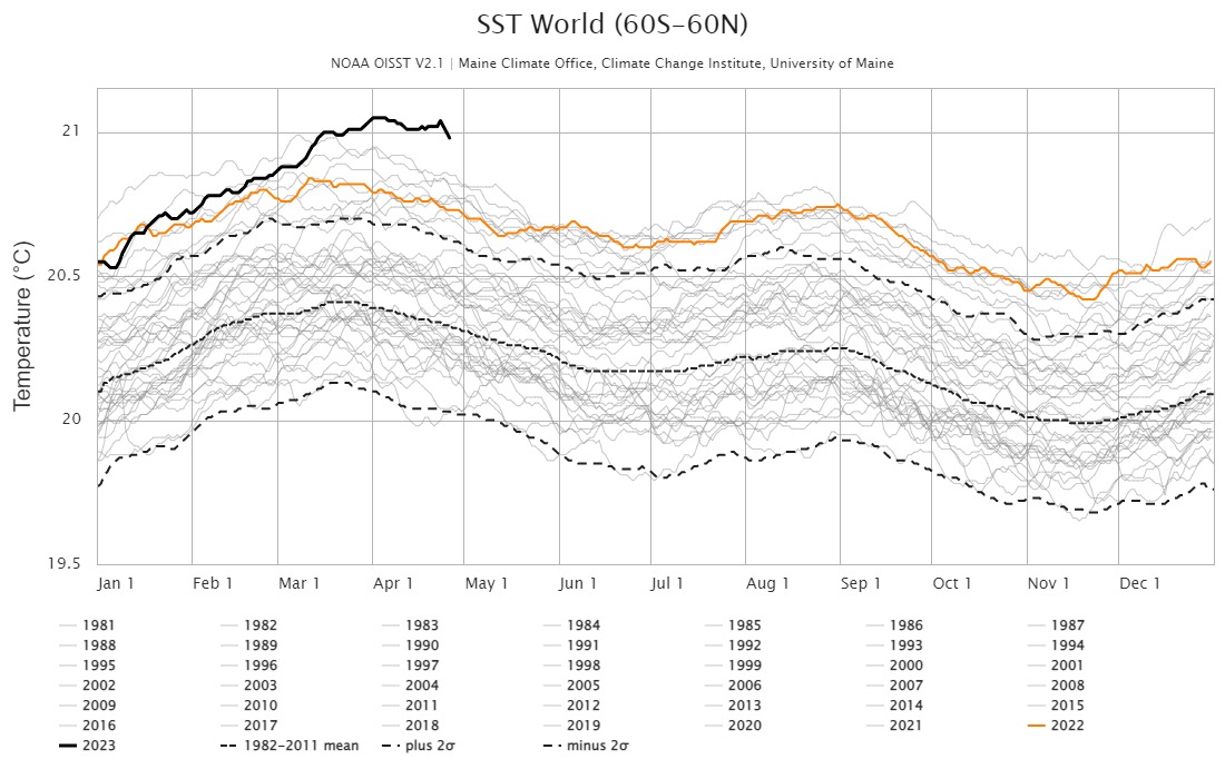
And if you want an idea of how current ocean temperatures match up to previous years, here you go. The dark black line is this year. So ya know, warm.
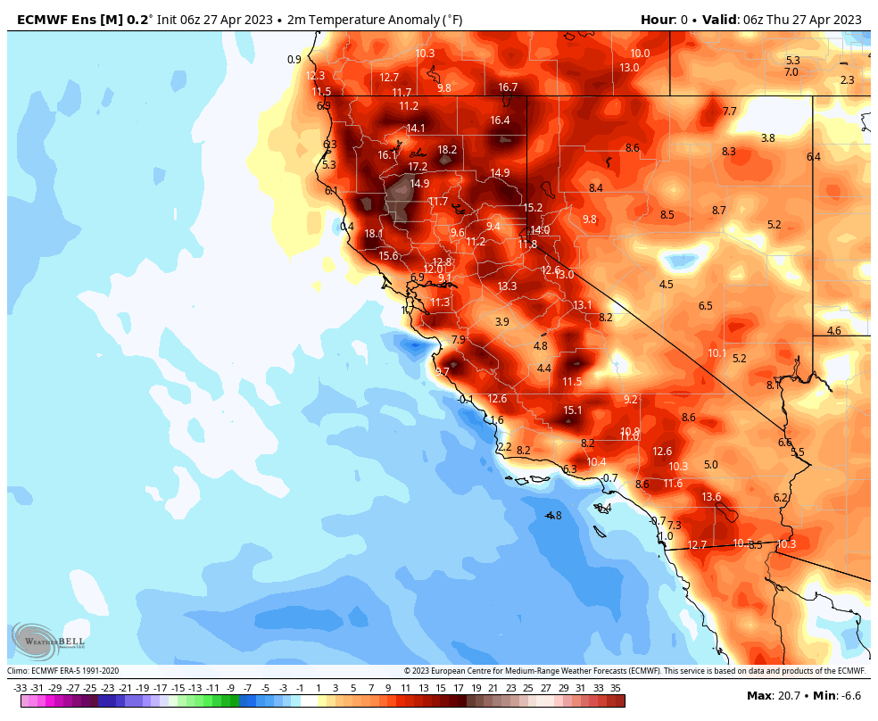
In the shorter term, we’re seeing above average temperatures in parts of California. We covered the 2m temperature anomaly map last time, which comes in handy here. This gif covers today through early next week.
The snowpack is obviously melting and it looks like they’re even going to close Yosemite. And speaking of flooding, it’s not just happening in California. The Mississippi is running high too (this is a video link FYI).
Weather Feed is a reader-supported publication. To receive new posts and support my work, consider becoming a free or paid subscriber.
Gonna need a bigger bat
For all this hail. Texas, Florida, and other areas saw thunderstorms and a ton of hail over the last few days. Here’s some satellite footage of the Texas storms (credit to GOES-16, -17, or -18, credit: ‘CIRA/CSU and NOAA’, CIRU/CSU website).
Let’s talk terms
The LA Times published an article about weather terminology. We’ve covered this a bit before and it’ll likely continue to come up as we talk about weather and science communication.
The LA Times article goes a bit deeper into when these terms (that have been around for quite a while in scientific literature) started being used more generally. The article also defines several terms and collects input from meteorologists on those terms.
And relatedly, I stumbled on this page about derechos if you haven’t heard of that one yet.
Office hours next week with Daniel Swain
On YouTube as usual. I’ll try to take notes for you!
It’s all connected
This article from the National Snow and Ice Data Center explains how tropical moisture makes it to the Arctic and the impacts it has. It’s a cool reminder of the long distance connections in the atmosphere.
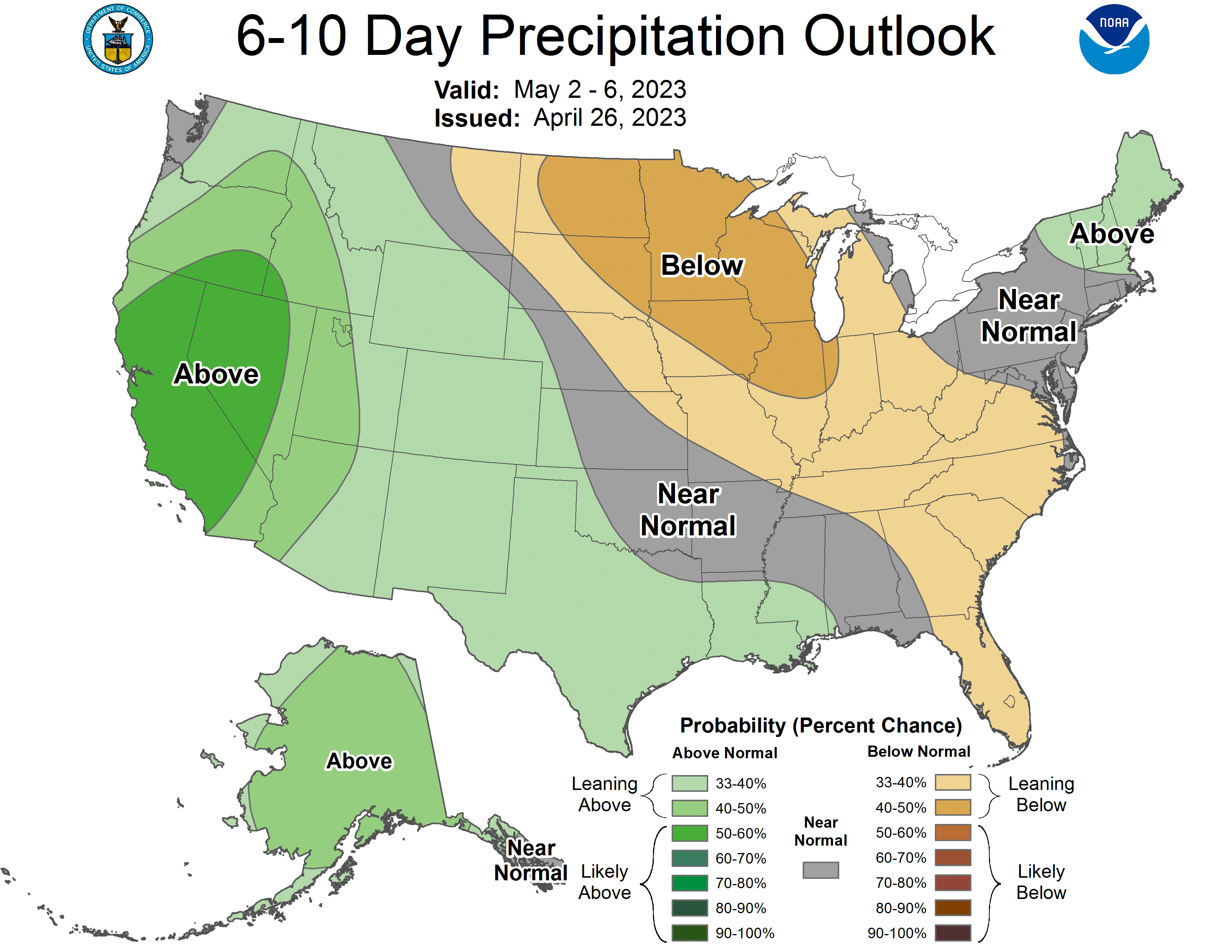
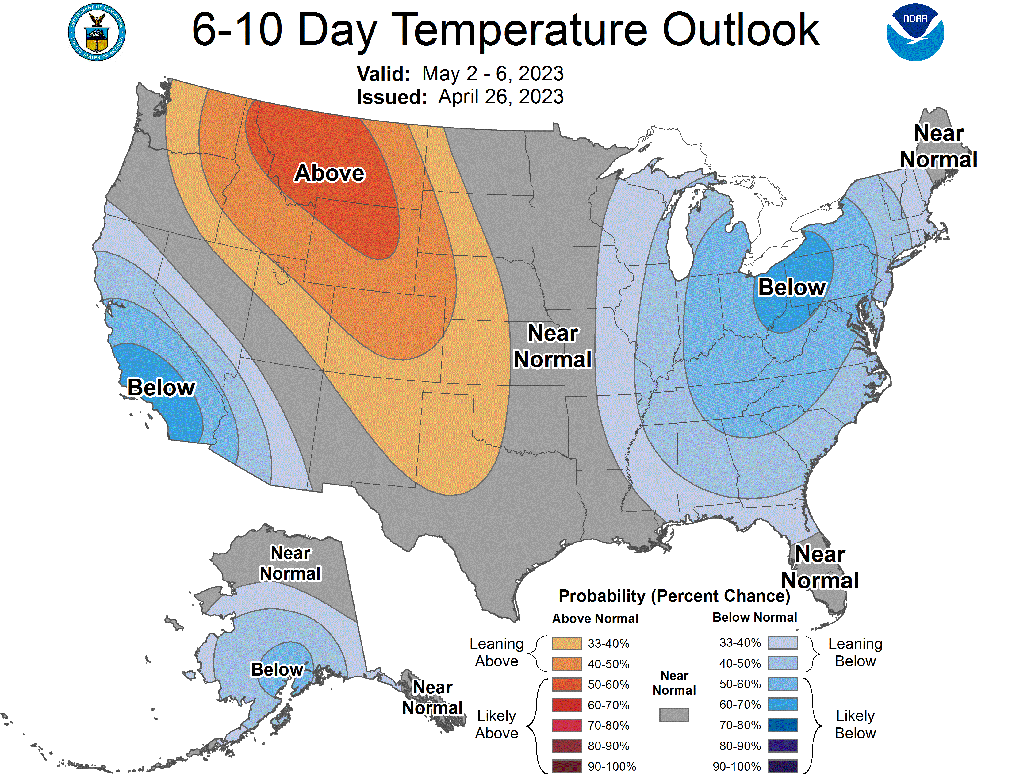
6-10 outlooks
For us in CA, looks like we’ll cool down and maybe have a chance at some rain. Have to stay tuned for that though!
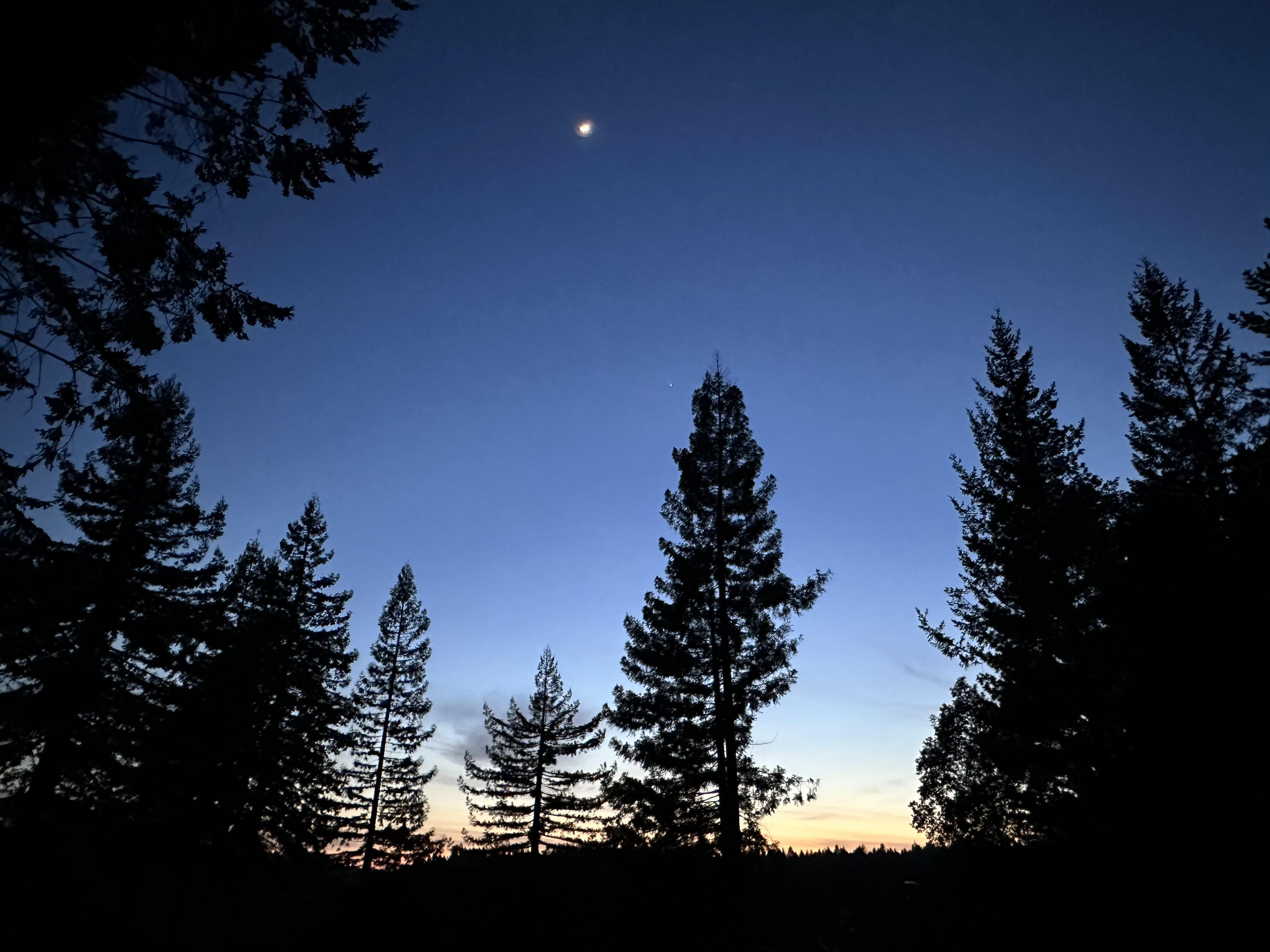
The sun sets on another issue
See you next time.