Let’s do this
In which we make it official and introduce Drax the Weather Dog.
A few things before we jump in…
- Welcome to the new subscribers! It’s good to have you here 💙.
- We had a holiday last week so this post is coming a bit later than usual.
- I won’t go into the details but social media apps and companies can be weird. I’m still technically on Twitter but I’ll likely be moving to Bluesky (how could I not with a name like that?). I’m not on there yet though, still waiting on a direct invite or an invite code. Let me know if you have a spare one!
Now, on with the show.
I see you California
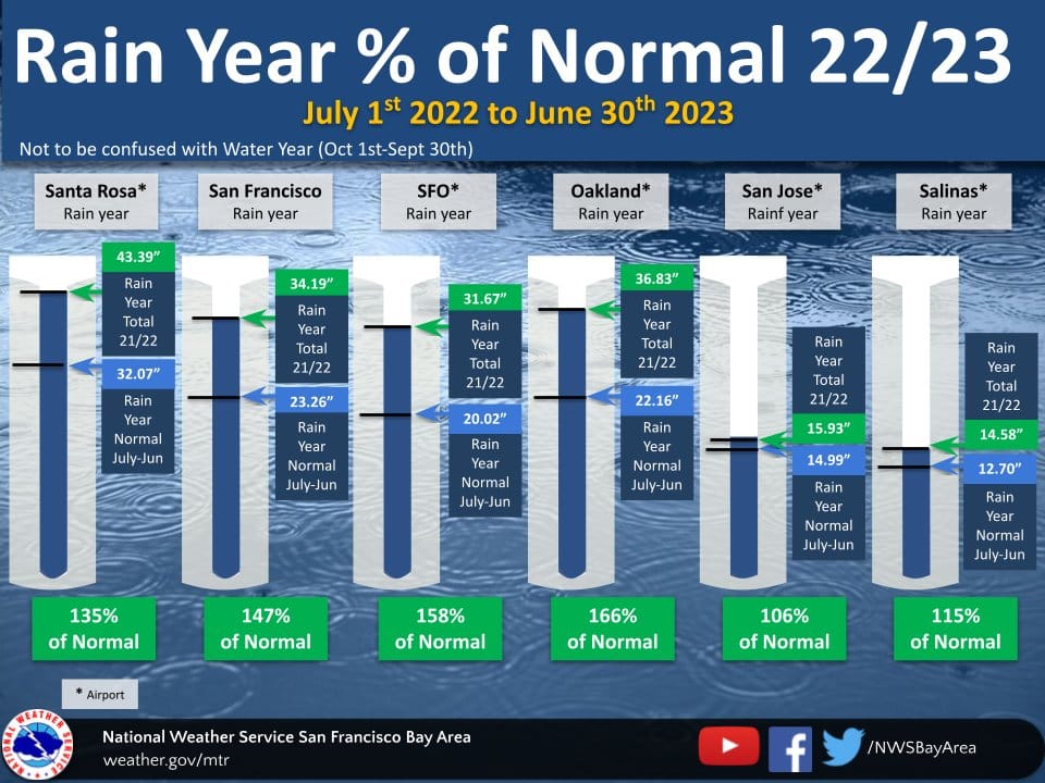
First, let’s look at this past Rain Year.
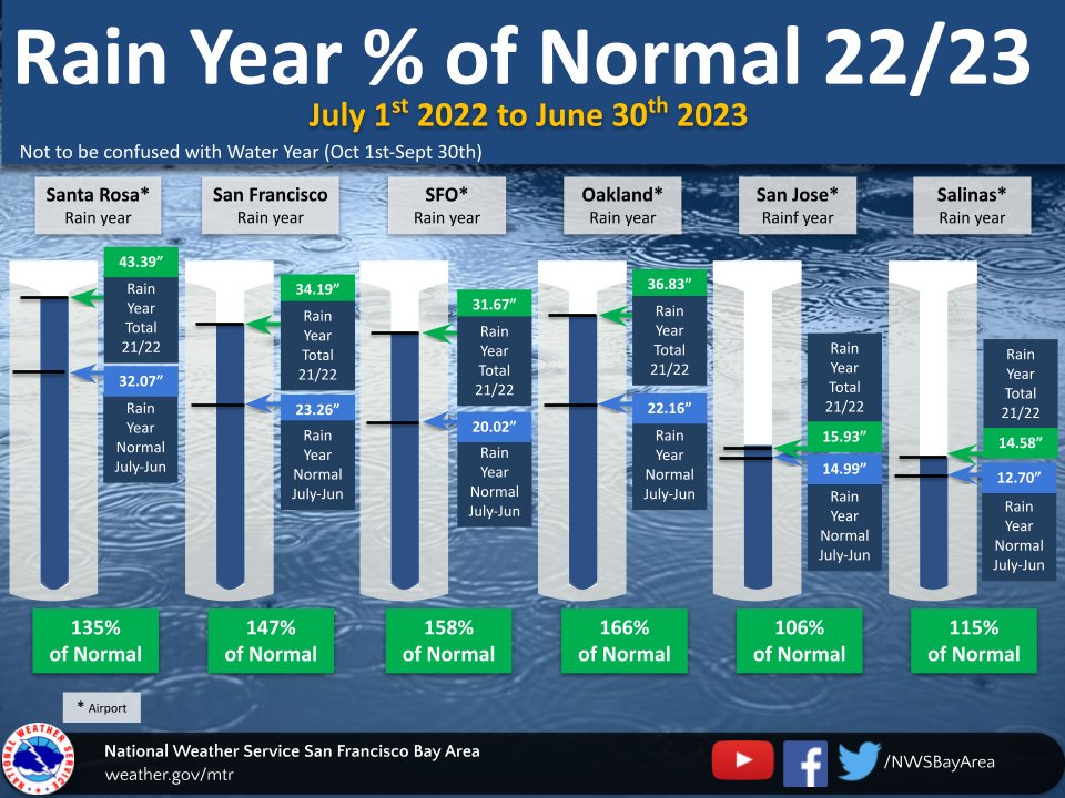
You probably aren’t very surprised to see those numbers, but I wanted to specifically call out the difference between the Rain Year (July 1-June 30) and the Water Year (Oct 1-Sept 30). California focuses a lot on the Water Year, but many places in the U.S. focus on the Rain Year. On a hyper local level, the difference in timeframe actually resulted in a ~4-6 inch difference between the two time spans.
Looking forward now, much of California is expected to see its first significant heatwave over the next week or so. Take this with a grain of salt, but here’s a GIF of projected 2 meter temperatures from the ECMWF ensemble model (between about now and next Monday).
We’ll of course see how things play out, but I’m preparing for some sustained warm temps for sure. And to back that up a bit, here’s the temperature outlook from the Climate Prediction Center.
Here comes the rain again
At least for New England. That area of the country has seen major flooding recently, and the rain isn’t quite done yet.
The Weather Feed is a reader-supported publication. To receive new posts and support my work, consider subscribing or sharing with a friend!
We’re always learning
Noctilucent was Dictionary.com’s word of the day recently. It’s an adjective that means:
(of high-altitude clouds) visible during the short night of the summer.
This was a new one for me so I thought I’d share. And, the AMS recently shared their word of the week: North Atlantic Oscillation.
The North Atlantic Oscillation (NAO) refers to a redistribution of atmospheric mass between the Arctic and subtropical Atlantic, manifesting as a north–south seesaw in the North Atlantic sea level pressure and geopotential height fields. The NAO is one of the dominant patterns of Northern Hemisphere climate variability, with significant impacts across much of North America, North Africa, Eurasia, and the Arctic.
The WMO makes it official
Not super surprising but the World Meteorological Organization made a post about El Niño conditions. This is their summary of the current conditions and the outlook:
Since February 2023, monthly average sea surface temperature anomalies in the central-eastern equatorial Pacific have warmed significantly, rising from nearly half degree Celsius below average (-0.44 in February, 2023) to around half degree Celsius above average (+0.47 in May, 2023). In the week centered on June 14, 2023, the warm sea surface temperature anomalies have continued to increase, reaching a value of +0.9 degrees Celsius.
The collective evidence from both oceanic and atmospheric observations strongly points towards the presence of El Niño conditions in the Pacific. However, some uncertainty remains because of only weak ocean-atmosphere coupling, which is crucial for the amplification and sustenance of El Niño. It is anticipated that it will take approximately another month or so to witness a fully established coupling in the tropical Pacific.
The main thing I took away was that even though we’re on our way, it could take another month or so for things to kick up a notch. Something that Daniel Swain also mentioned in…
Office hours!
Here’s the YouTube link (there were some technical difficulties so I did you a favor and linked to a spot in the video after they’re figured out).
As usual, here are my very brief notes:
Been fairly quiet in CA, first heatwave for many is on the way
While it has been cooler in CA, many parts of the world have been super hot (Texas, northern Mexico, southern Europe, northern Africa, parts of the Canadian Arctic, you get it…)
Here are some related articles I dug up: WMO post, Grist article
June 28th Weather West blog post went out
El Niño stalling a bit now, could be 1-2 months before it kicks in some more
If fire season ticks up in California and the rest of the U.S., we could see the resources we’d sent to Canada called back
And just some fun stuff
My swag came!
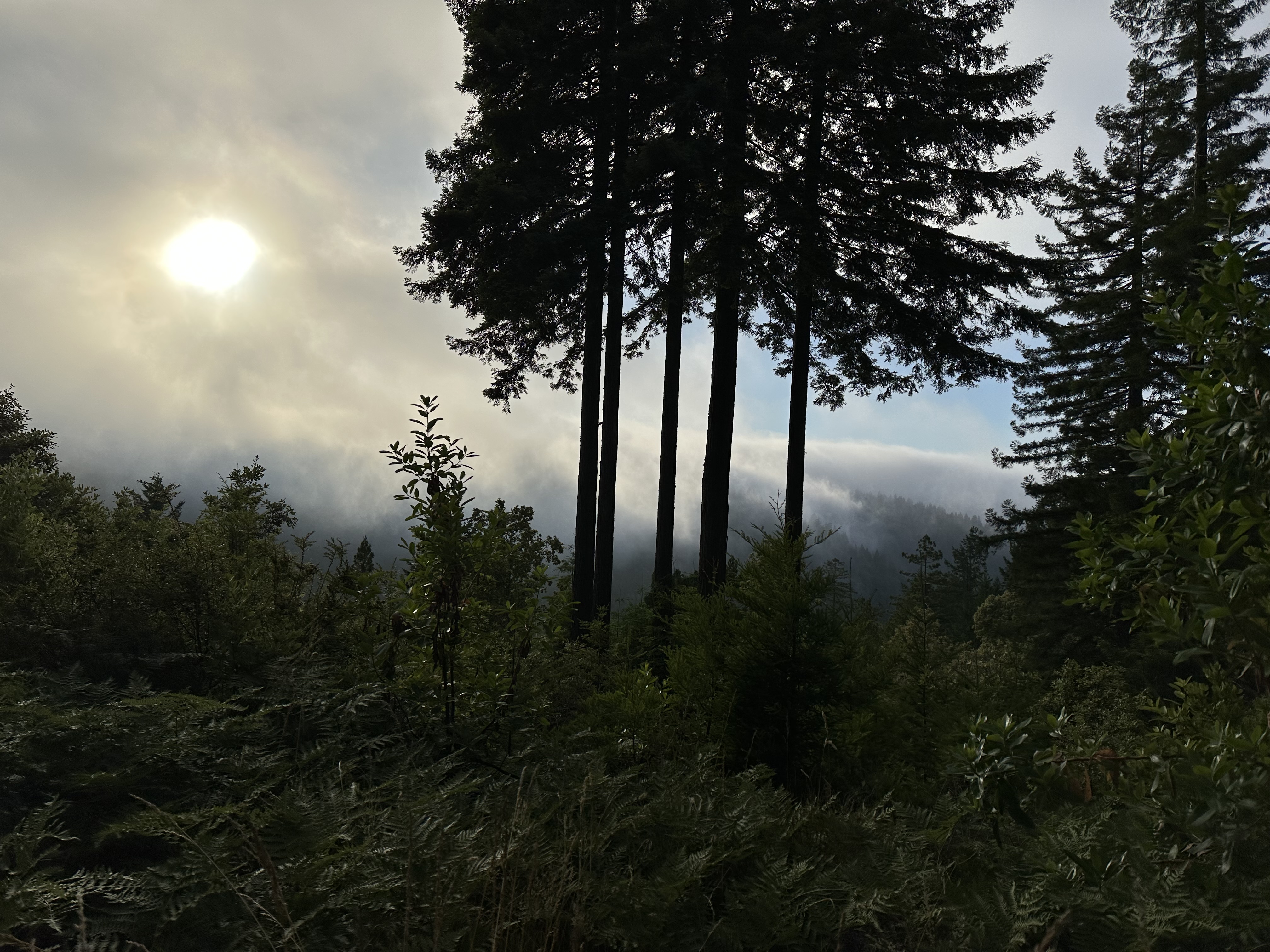
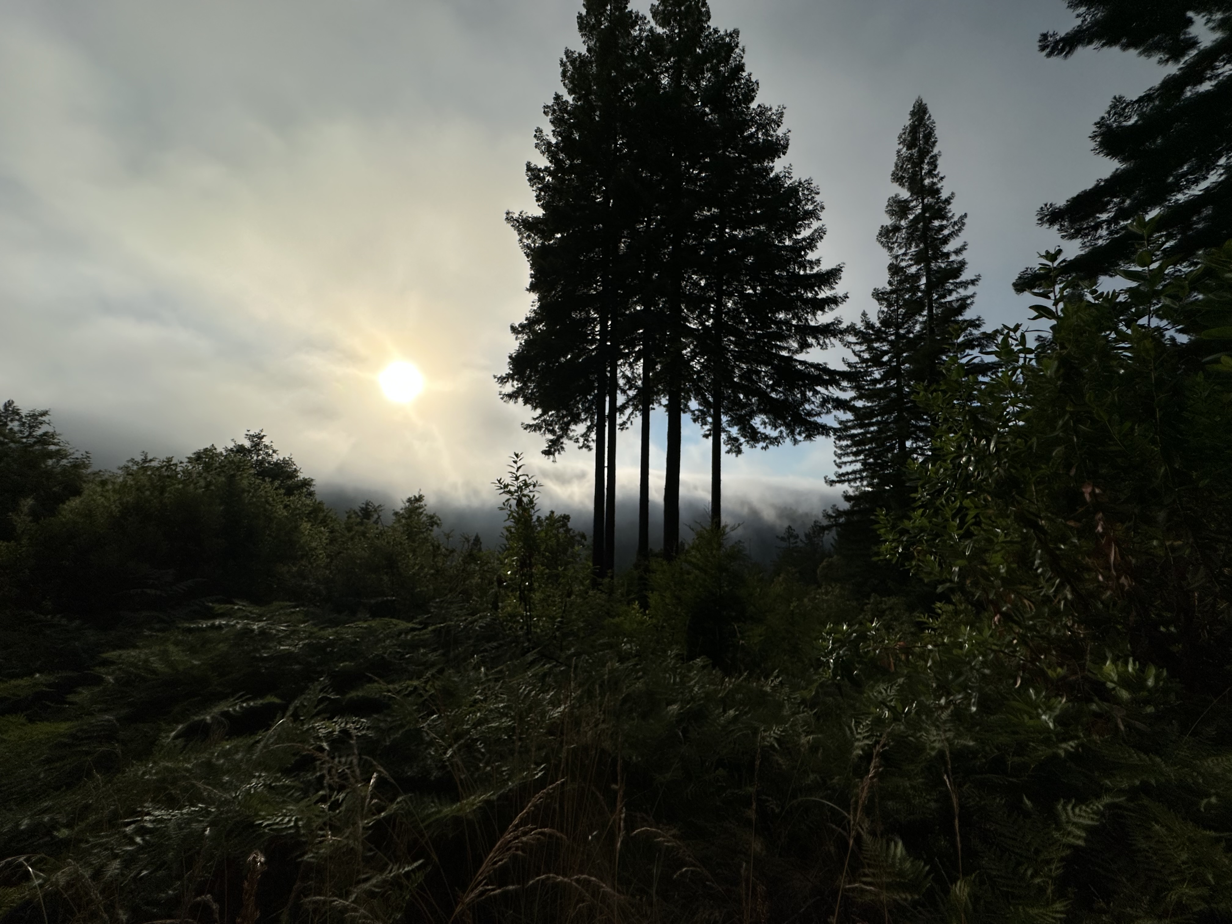
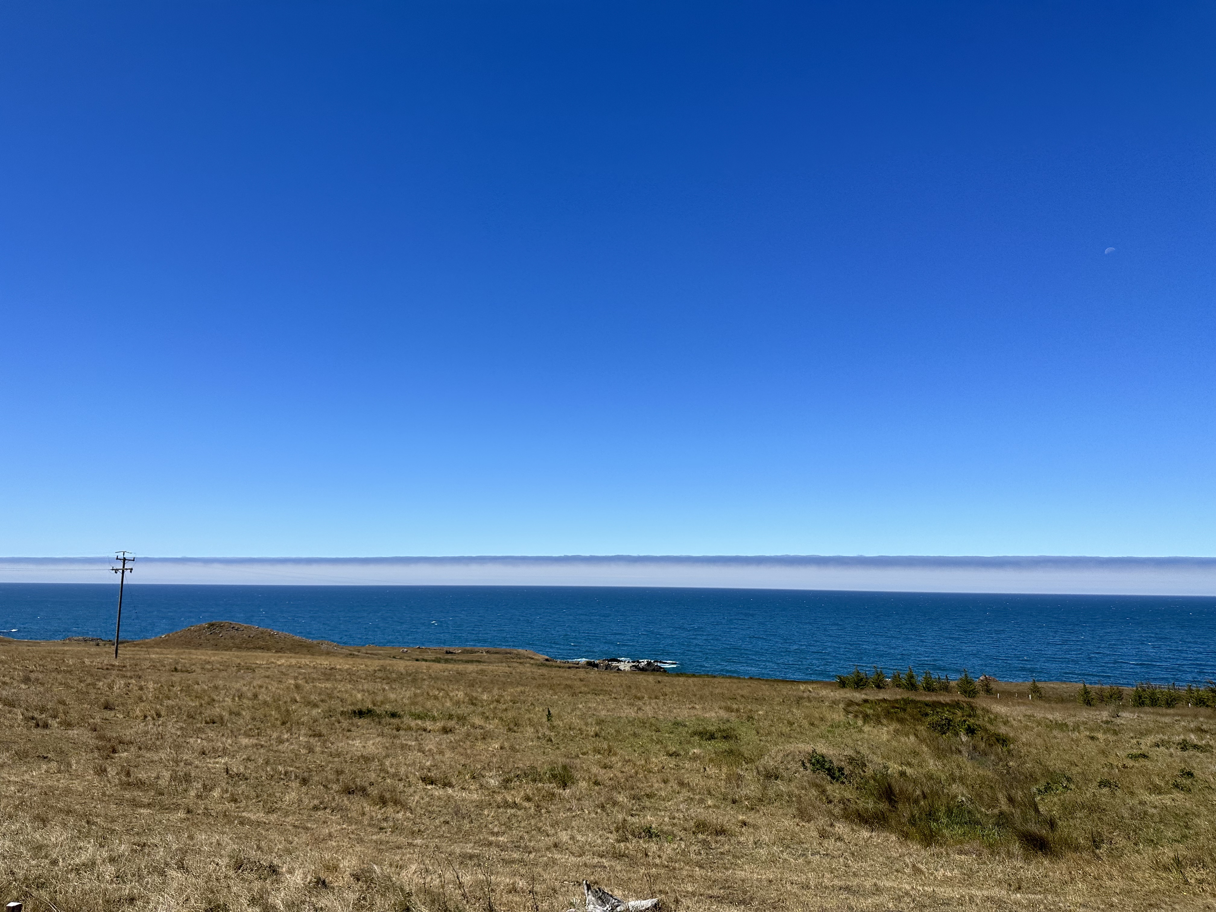
We grabbed some nice photos of the fog last week.
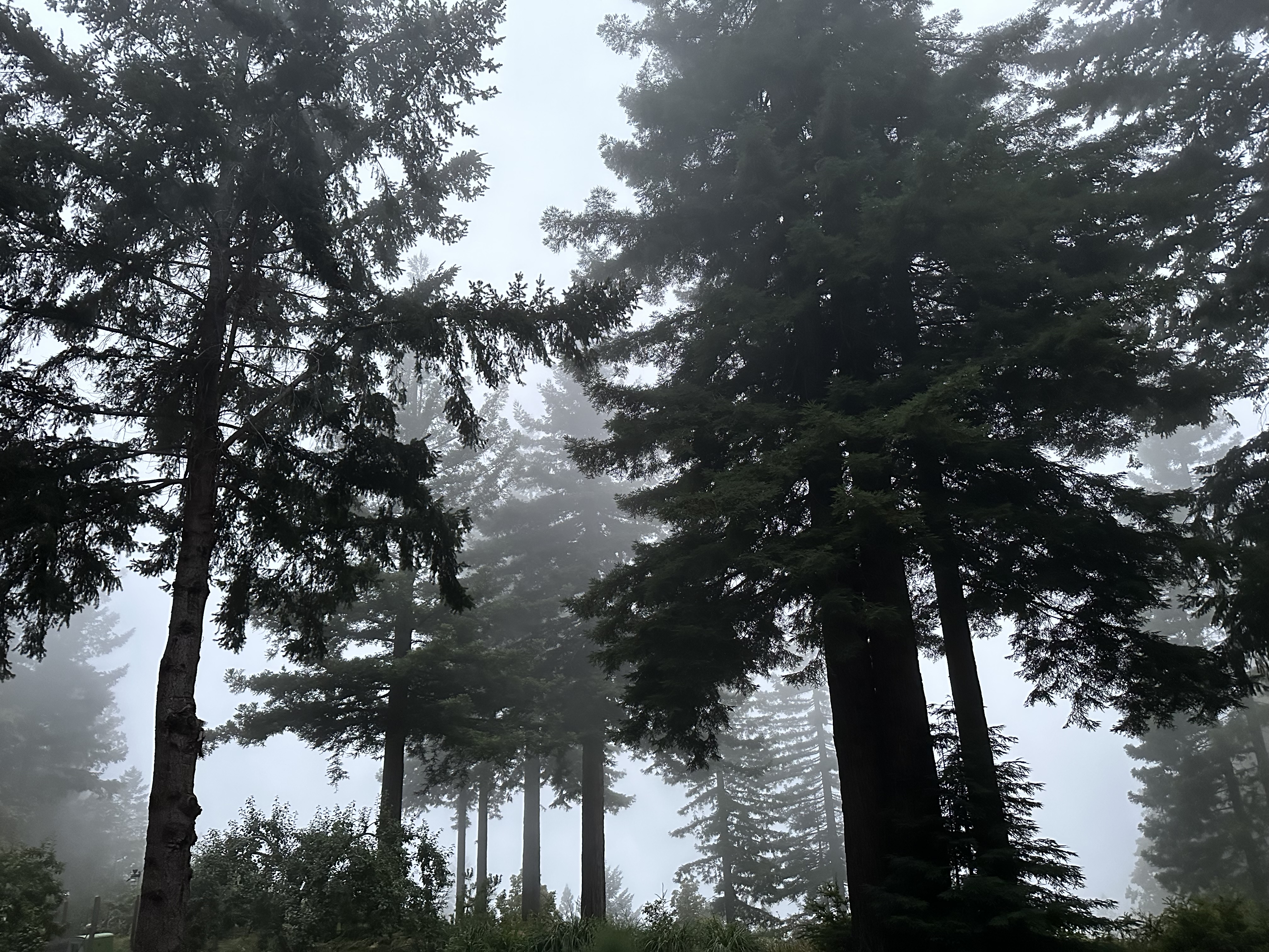
And here’s Drax the Weather Dog taking a close look at the marine layer.
See you next time weather fam
Stay cool 💙


