How is it Sunday already?
In which we catch up on a few things and sing along to our favorite tune.

It starts with an H
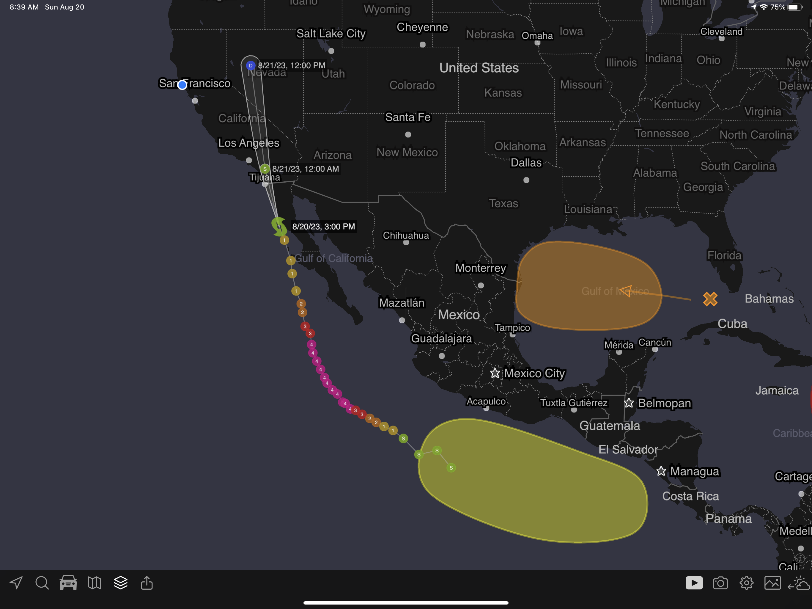
And ends in “ilary”. Hurricane Hilary made it to category 4 but has weakened (as expected) to a tropical storm. This actually happened while drafting this post, so I had to make a few updates.
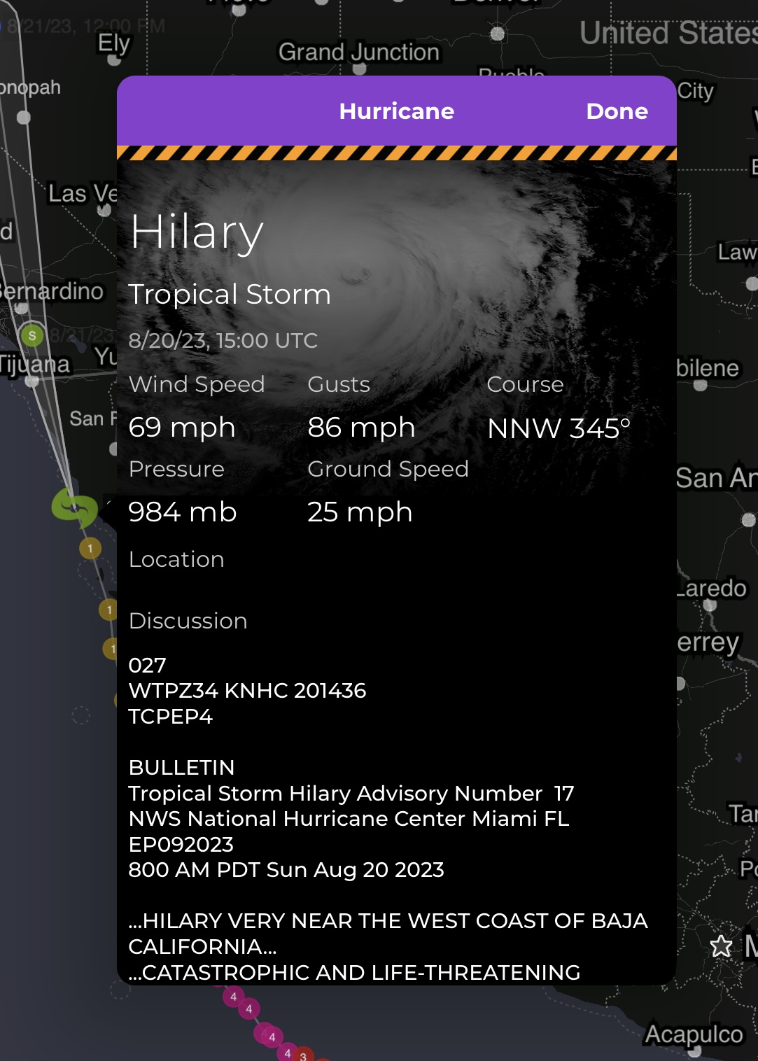
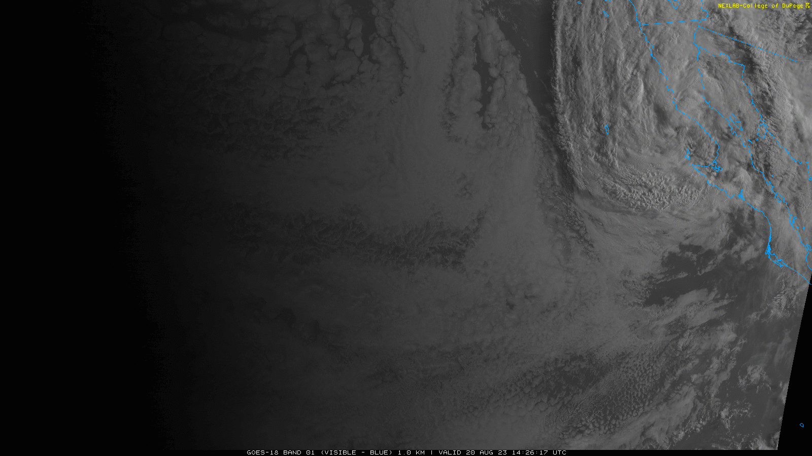
And for your viewing pleasure, here’s a recent satellite loop of the storm (it’s that bit in the top right).
You might be on “Hilary overload” if you’ve been keeping tabs on it, but there are two things I wanted to note about this storm that have been educational and interesting:
- There are three things that generally prevent events like this happening in California.
- There are two pressure systems contributing to Hilary’s trajectory.
One, two, three
In short, storms like Hilary usually die out and recurve to the west, away from California. This is because:
- The waters off the coast of California are cold and hurricanes don’t like that.
- There’s usually a wind that blows from east to west that sort of pushes storms away from the coast.
- Atmospheric subsidence, which is basically a broad downward flow of air over California, which hurricanes don’t like either.
You go high, I’ll go low
There’s a huge high pressure system over the Midwest, so on the right side of Hilary’s path. On the left side, there’s a low pressure system off of California. These systems are working together to make the wind blow from the south to the north (in the northern hemisphere, high pressure systems rotate clockwise, low pressure systems counter-clockwise).
If you want to dig into the details, here’s an LA Times article, Weather West’s recent blog post, and a link to Daniel Swain’s most recent office hours (my rough notes here).
And finally, if you’re in SoCal or any of the areas looking at serious impacts from Hilary, please be safe! (The music video is humorous but the message is legit!)
The Weather Feed is a reader-supported publication. To receive new posts and support my work, consider becoming a free or paid subscriber.
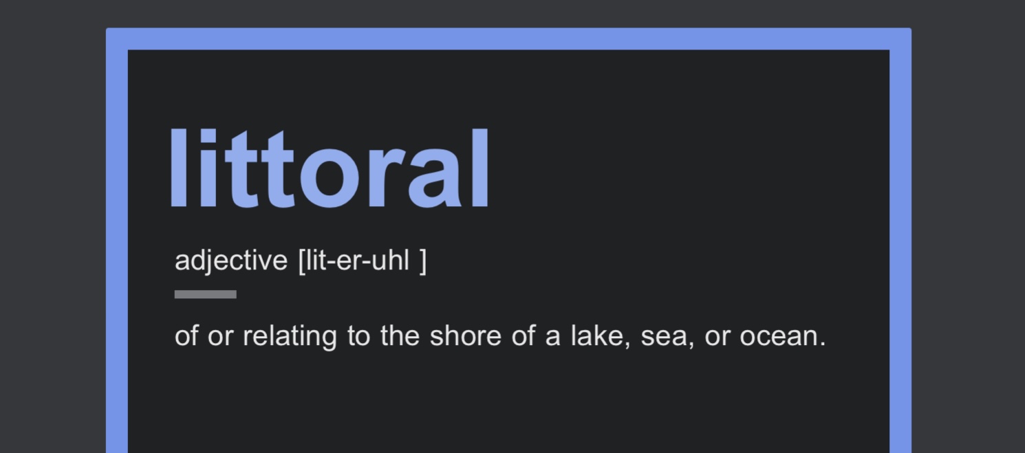
It’s littoral, not literal
Hadn’t heard this one before (we’re always learning right?) so I thought I’d share this recent word of the day.
Atlantic hurricane season updates
NOAA put out their update recently.
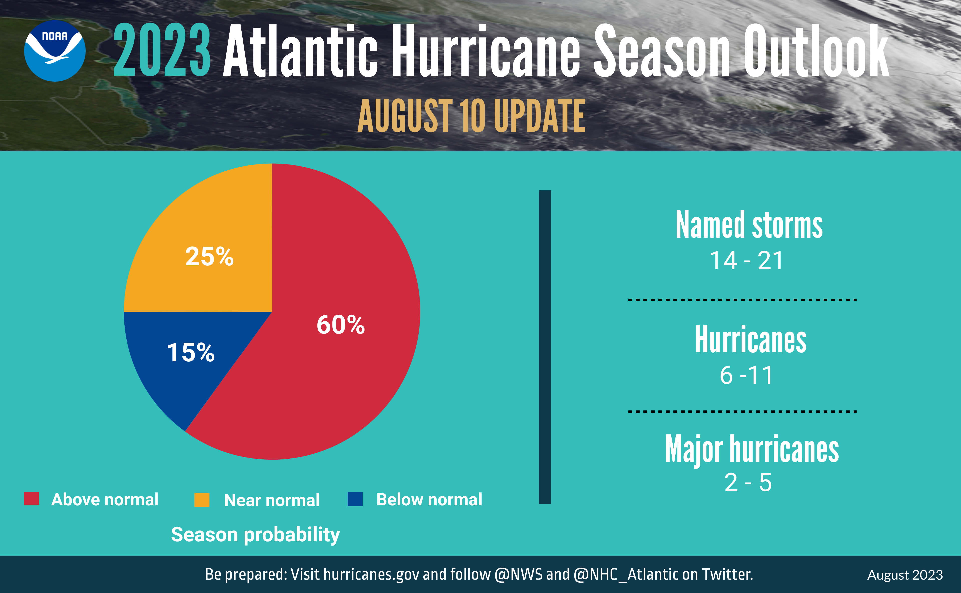
Scientists at NOAA’s Climate Prediction Center — a division of the National Weather Service — have increased their prediction for the ongoing 2023 Atlantic hurricane season from a near-normal level of activity to an above-normal level of activity with today’s update. Forecasters believe that current ocean and atmospheric conditions, such as record-warm Atlantic sea surface temperatures, are likely to counterbalance the usually limiting atmospheric conditions associated with the ongoing El Nino event.
And if that’s not enough of an update, WeatherTiger recently published their outlook too.

El Niño, where you at?
It’s definitely time for an update and we’ve got a few resources to share:
Here’s the CPC’s synopsis:
El Niño is anticipated to continue through the Northern Hemisphere winter (with greater than 95% chance through December 2023 -February 2024).
If you want the details though for where that 95% came from and what it means, definitely take a look at the ENSO blog post linked above.
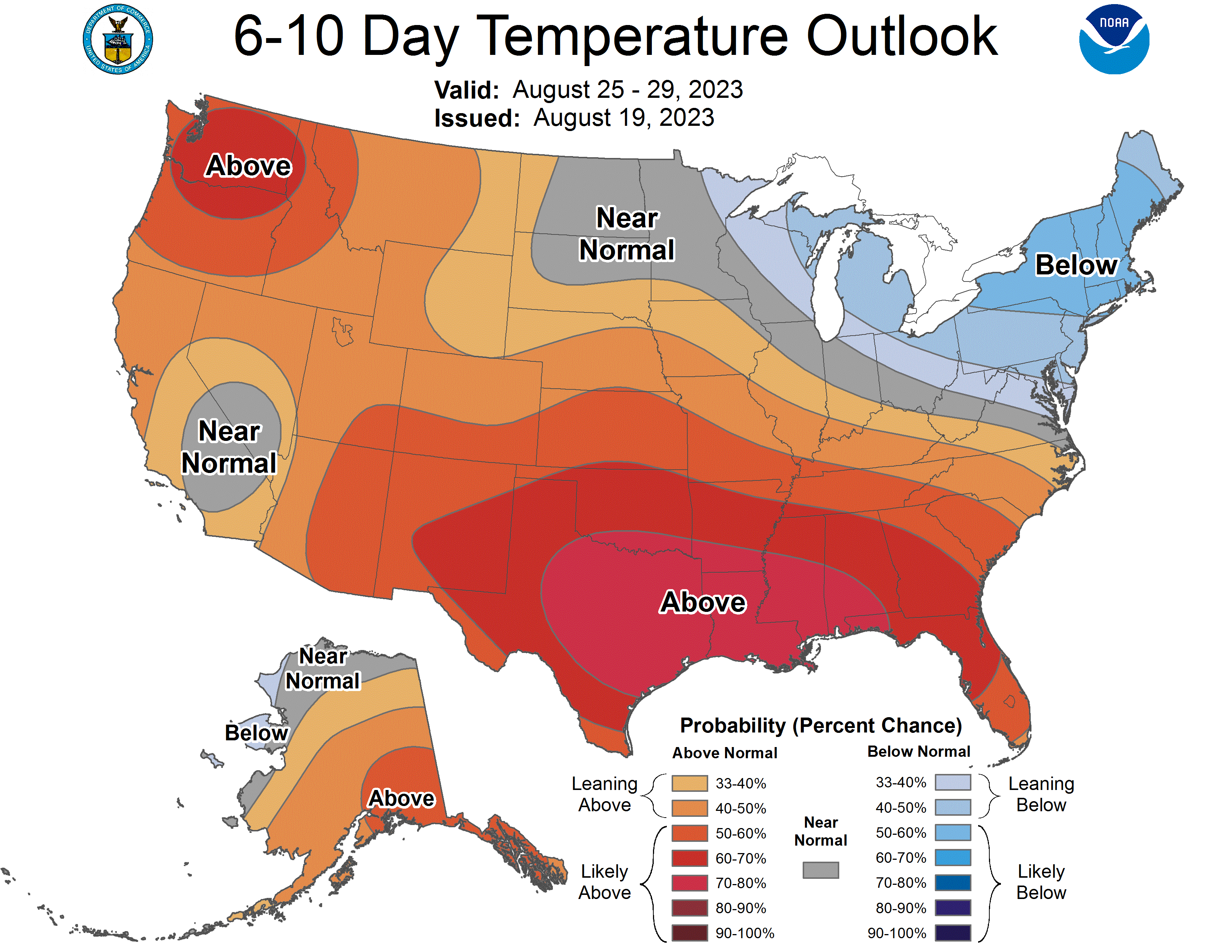
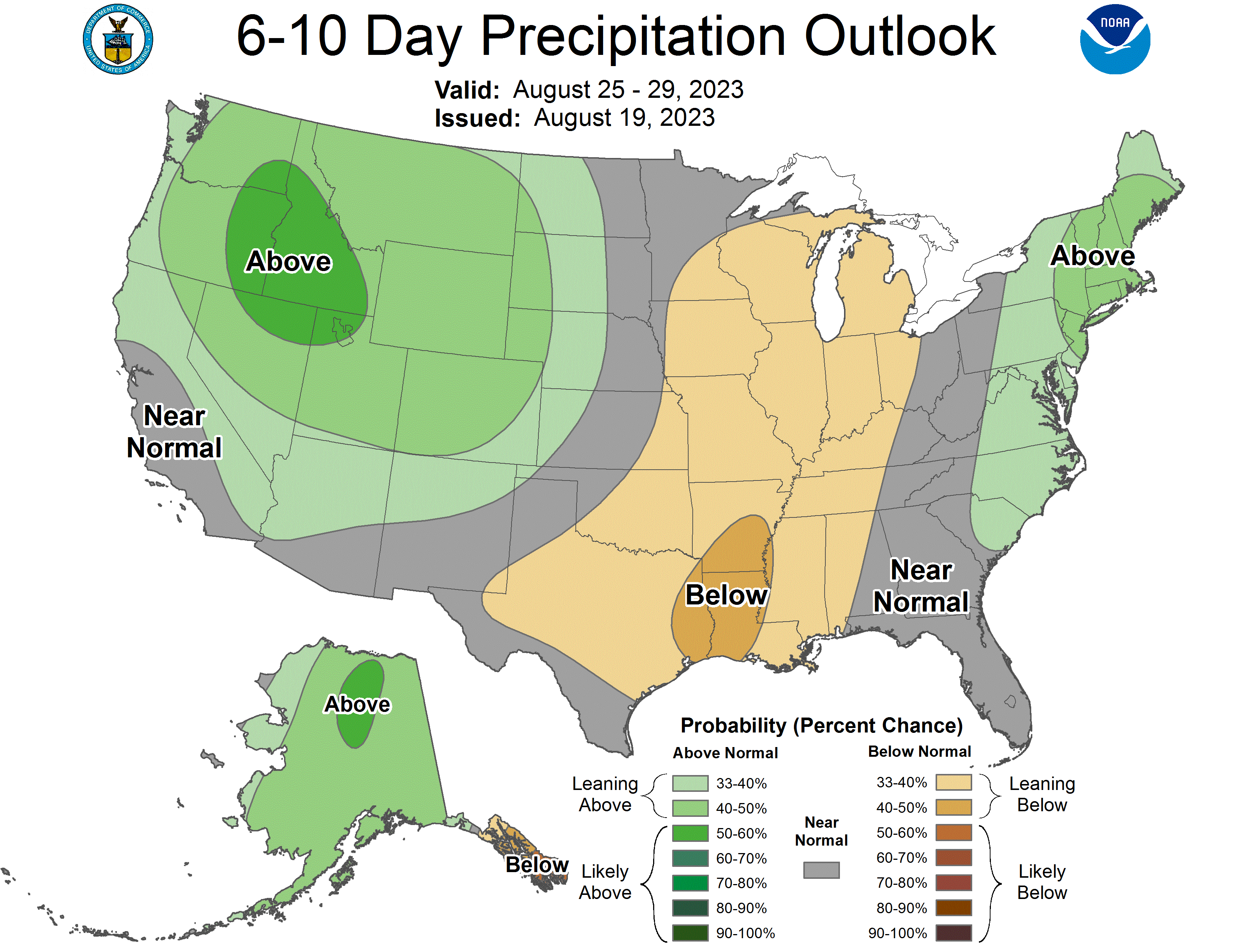
I’ll have the usual
Here are your 6-10 day outlooks. Apologies to those that are sick of seeing all that red.
See you next time weather fam 💙
I’ll leave you with calm Pacific waters and some cool clouds.

Thank you for reading The Weather Feed. This post is public so feel free to share it.


