Hope you made it through your Monday
In which we talk about buoys and watch some movies with a met.

Some new segments
Over the next few weeks, I’m going to try out some recurring segments: a high-level national look at the weather, a weather model intro section, and some kind of satellite or radar imagery. Let me know what you think!
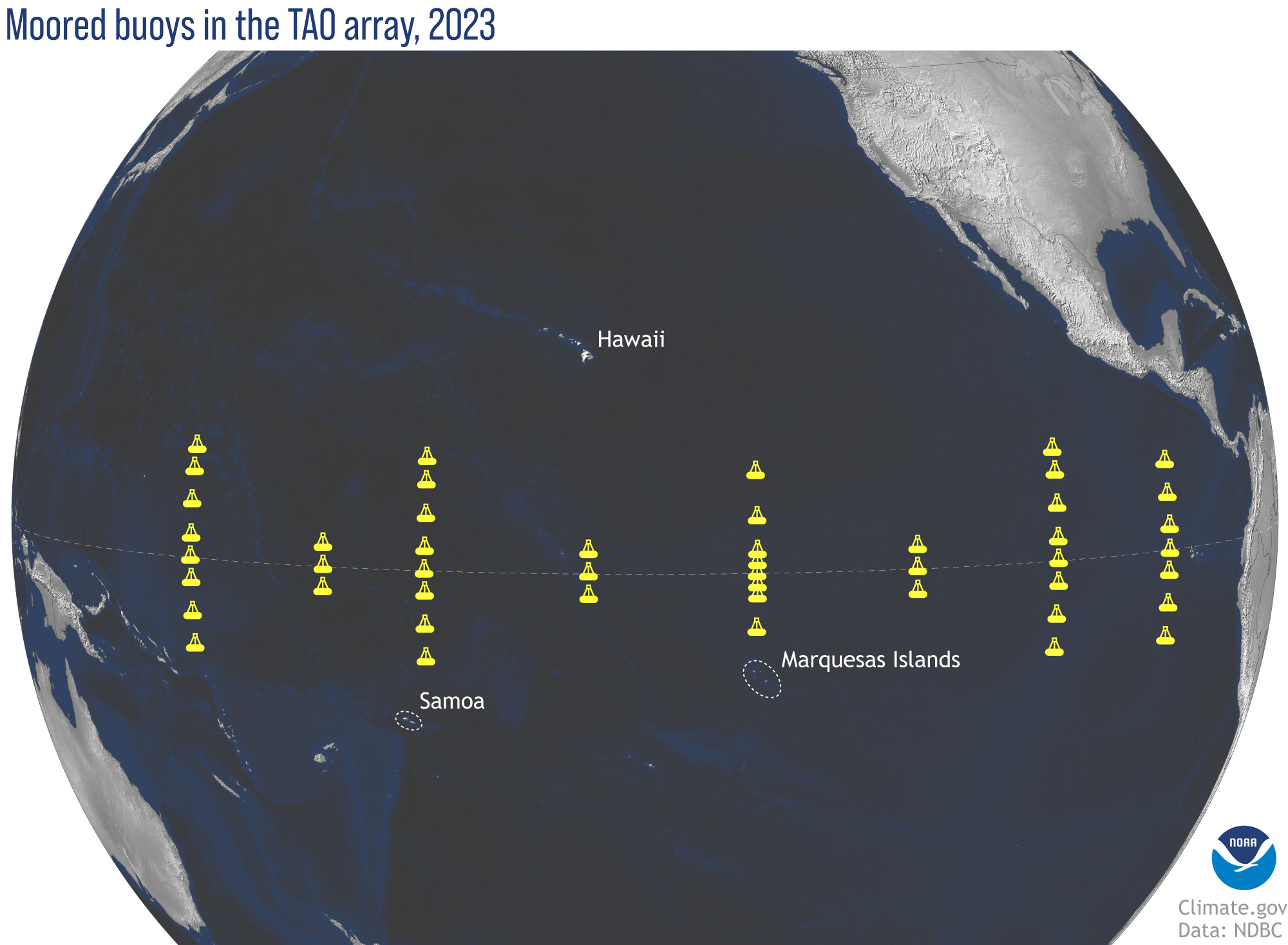
Yeah buoy!
The Pacific Tropical Atmosphere-Ocean (Pacific TAO) buoy array is getting some upgrades over the next several years. Not only is that an excellent acronym, it’s a pretty important set of buoys out in the Pacific Ocean. While there’s more to it than this, here’s a brief excerpt from the article.
The upgraded array will remove some buoy locations from the previous TAO array (12 buoys in total), while also putting additional buoys (five in total) in some locations to get a better view of ocean movement and the northern Intertropical Convergence Zone—where the northeast and southeast trade winds converge during the northern hemisphere summer. Better wind and rain observations in the Intertropical Convergence Zone will have multiple payoffs, including ground-truth for satellite-based wind estimates in areas with heavy rain and more real-time data in parts of the ocean where many tropical cyclones are born.
Here’s what the new array will look like, and if you’re really into buoys and want more data, we have a National Data Buoy Center site.
Storm Prediction Center (SPC) checkin
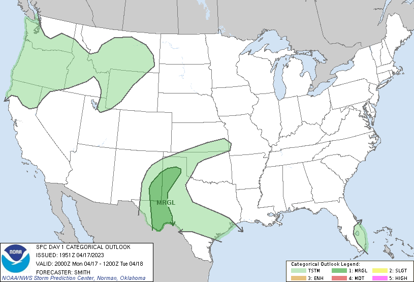
The convective outlook is a pretty standard product the SPC puts out:
Convective Outlooks consist of a narrative and a graphic depicting severe thunderstorm threats across the continental United States.
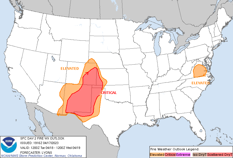
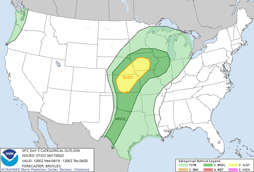
The one for today seems pretty mild (see the category definitions if you aren’t quite sure what they mean). However, looks like there’s some fire weather coming tomorrow, and then maybe some severe weather on Wednesday (Tornado Titans did a write up if you want some more details on this week).
Flashdance drought
Not quite sure where that reference came from…
So there’s a new drought study coming out, but what grabbed my attention was the mention of flash droughts. From that second link:
Flash droughts are droughts that develop rapidly, sometimes in as little as a few weeks. These types of droughts are challenging to forecast in comparison to slower forming droughts.
Which of course makes sense, but I found it interesting because we hear so much about longer term droughts. And these flash droughts can be super costly:
In 2012, a severe flash drought in the United States resulted in economic losses of $30 billion USD, and a flash drought in Southern China in 2013 led to two million hectares of damaged crops.
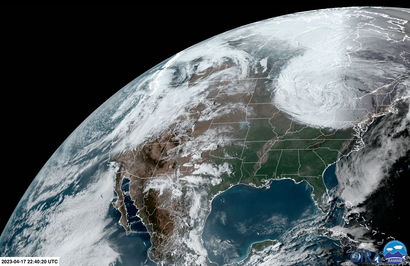
Some satellite imagery from today
Good night East coast!
Not the weather content you expect
MyRadar just put this out.
They have one of their hurricane experts react to some weather movies. Pretty solid content 👌.
And a few WaPo articles
The Washington Post put out an article on a heat wave in Asia and the potential for a quieter hurricane season this year.
See you next time weather fam
Oh, and happy Earth week!
Weather Feed is a reader-supported publication. To receive new posts and support my work, consider becoming a free or paid subscriber.


