Here we go again
In which we spend a day with a hurricane hunter and look ahead.

Yeah, my day looks a little different
Believe it or not, hurricane hunters don’t just jump into planes and fly around. I mean, they do do that, but there’s obviously more to the job. The article runs through a typical research mission and has interviews with a few hurricane hunters.
Stumbled on a new app
There’s a GOES Viewer app for iOS that lets you look at images and gifs. I’ve been using it a lot lately so I thought I’d share. Some proof:
Sorry, no notes this time
Daniel Swain had office hours today. It was more of a Q&A session. Some interesting questions but no notes this time.
A different angle
There have been a lot of aurora images floating around lately. Someone put together a timelapse from space though which is very rad.
Weather Feed is a reader-supported publication. To receive new posts and support my work, consider becoming a free or paid subscriber.
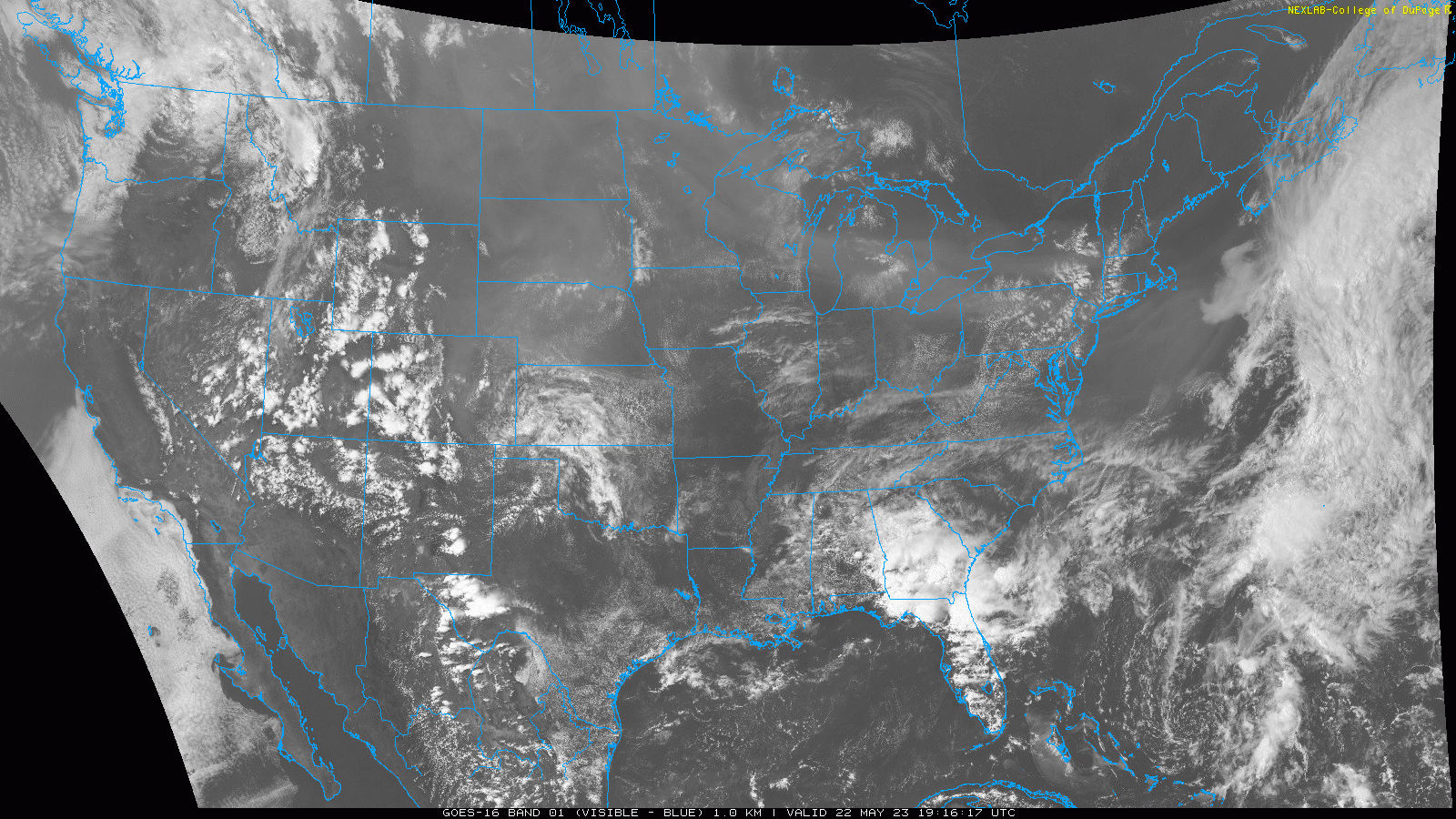
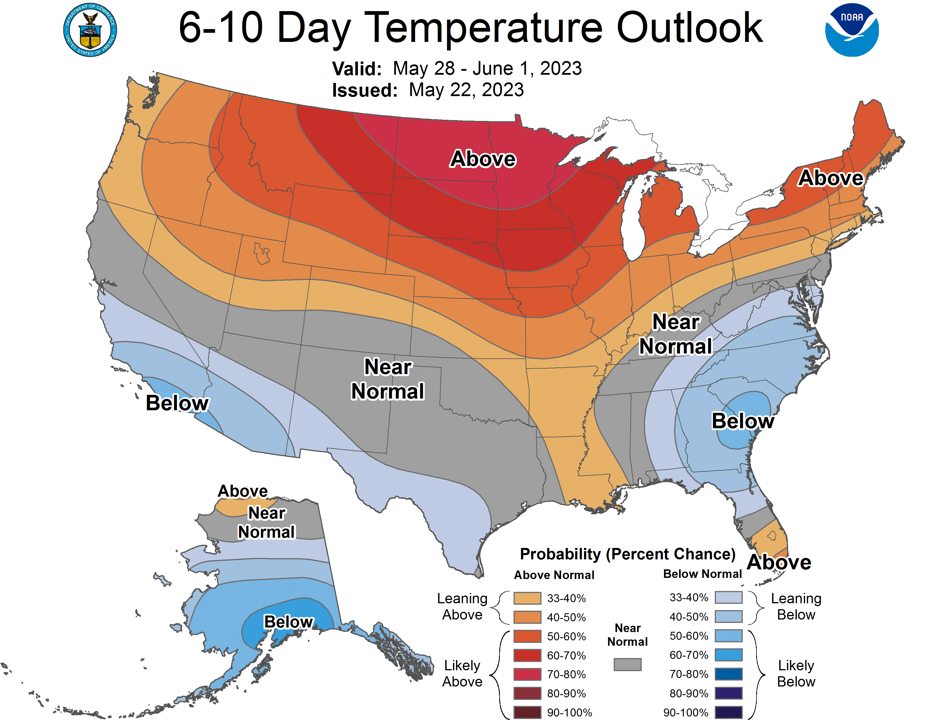
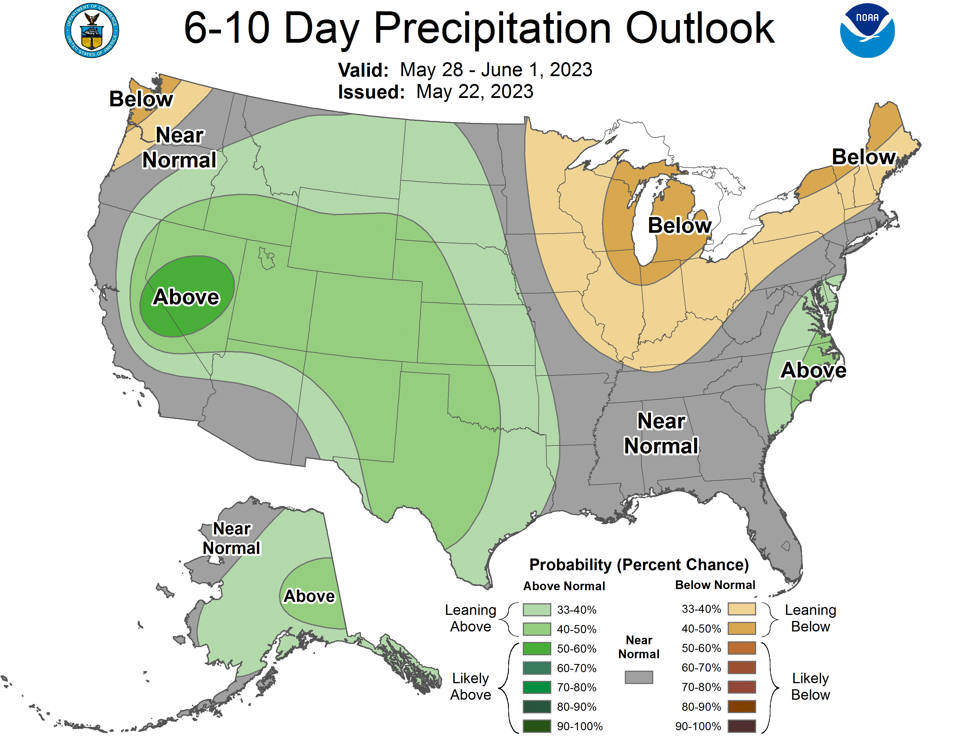
It’s Monday
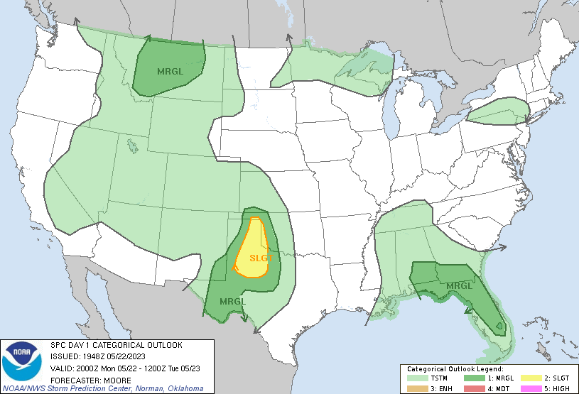
So let’s look at what’s going on now and in the 6-10 outlooks. A bit of satellite imagery for you first.
Which matches up well with the convective outlook for today.
For us, today is our last warmish day it looks like for a while. It’s not going to be freezing or anything, but pretty mild for sure.
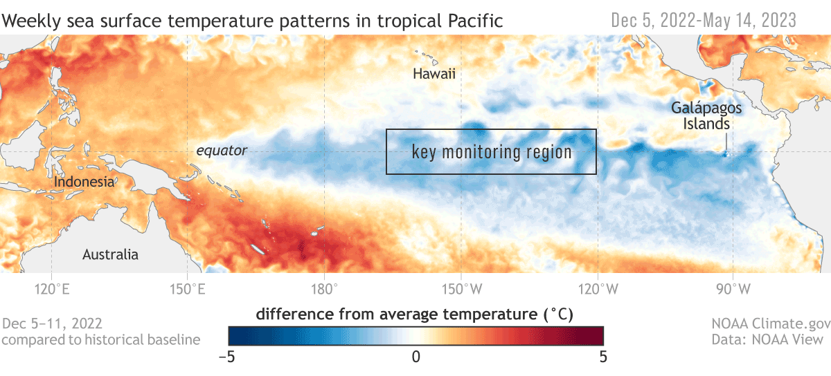
Wait, play it again
We talk about El Niño all the time, but here you can see the transition from La Niña to El Niño. Just keep your eye on that box.
See you next time weather fam
I’ll leave you with some photos from the weekend.


