A brief heads up
In which Freddy makes a return and we get tired of saying “atmospheric river”.

Ready Freddy
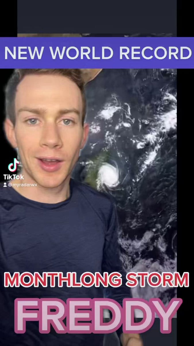
We covered Freddy for the first time back on February 21. And guess what? It’s still spinning!
UNPRECEDENTED — Cyclone Freddy has been spinning for a MONTH.
— MyRadar Weather (@MyRadarWX) 6:19 PM ∙ Mar 7, 2023
It rapidly intensified SIX times, has tracked 5,200 miles, is set to slam Mozambique a second time AND could churn through more ACE (accumulated cyclone energy) than any other storm.
Absolutely mind-boggling.
For #TimelapseTuesday, we're sharing three-week imagery of #CycloneFreddy's slow movement across the Indian Ocean to Africa via Europe's #Meteosat9 satellite.
— NOAA Satellites (@NOAASatellites) 4:57 PM ∙ Mar 7, 2023
Freddy now holds the world record for “accumulated cyclone energy,” a metric to gauge a cyclone’s strength over time.
You know the drill
Yep, there’s another atmospheric river on the way.
Quick video briefing on increasing potential for an atmospheric river and associated impacts from rain, wind, and thunderstorms later this week. Keep up with forecast changes and stay safe! #cawx
— NWS Bay Area 🌉 (@NWSBayArea) 8:49 PM ∙ Mar 6, 2023
Here’s everything I’ve been reading/watching about this next storm:
- Summary from the Center For Western Weather and Water Extremes (CW3E) (I know, weather has some of the best acronyms right?)
- Daniel Swain held office hours yesterday and also just published a post on Weather West. He’s doing office hours again tomorrow at 4pm.
- Articles from Gerry Díaz (SF Chronicle) and Matthew Cappucci WaPo).
My main takeaways from watching the office hours were:
- Yes, we’re getting a moderate storm starting this Thursday and into the weekend.
- By itself, it’s not a super crazy event and his (Daniel Swain’s) primary concern was whether or not there would be subsequent storms.
Still thinking about El Niño
Make sure to read the last sentence in the tweet. Still looks like it’s coming but we’ll see.
ECMWF is quite aggressive at calling for #ElNino this summer and fall. Generally, El Nino reduces Atlantic #hurricane activity via increase in vertical wind shear. ECMWF has tended to have a warm bias in its springtime ENSO forecasts in recent years, however.
— Philip Klotzbach (@philklotzbach) 12:52 AM ∙ Mar 7, 2023
Of course there’s a TED talk
In a previous newsletter, I touched on some of the difficulties of communicating weather hazards. James Spann did a talk that was very much related to this and it’s interesting to hear the point of view from a tenured broadcast meteorologist.
I can’t link to the section, but Daniel Swain also reflected on communicating risks to diverse audiences in his latest post.
Radar birds
It’s not really unique to Texas but it’s still pretty dang cool.
Any guesses as to what these sudden splotches on radar near Fort Worth, Texas are?
— MyRadar Weather (@MyRadarWX) 12:49 PM ∙ Mar 4, 2023
Birds!
We call them “roost rings.” The birds take off at sunrise and disperse.
That’s it for now weather fam
I wanted to get this newsletter out ahead of the Thursday storm so it’s a bit short. See you next time!
Weather Feed is a reader-supported publication. To receive new posts and support my work, consider becoming a free or paid subscriber.


